Rail Station
-
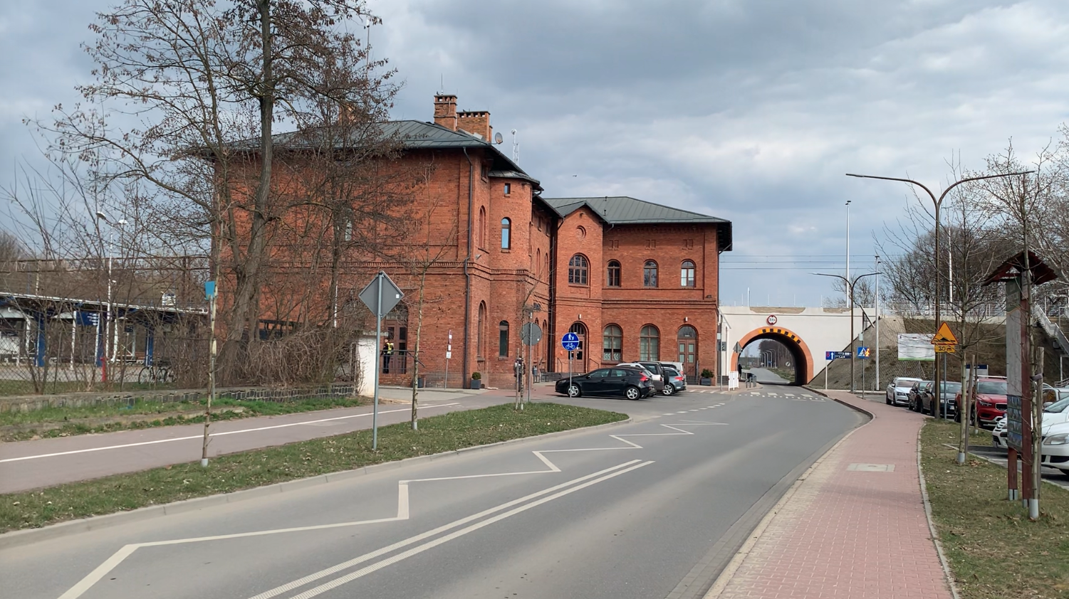
PKP Kępno Station. 2026
Kępno 2026-04-21 Kępno Railway Station. Address; Dworcowa Street 11, 63-600 Kępno, Poland. Geographic coordinates: 51.291N 18.000E. Elevation: 172 m. Kępno is a railway junction, where railway lines No. 272 Poznań Główny – Kępno – Kluczbork, No. 181 Herby Nowe – Oleśnica, and No. 307 Kępno – Namysłów (temporarily closed) intersect. The town has a functioning…
-
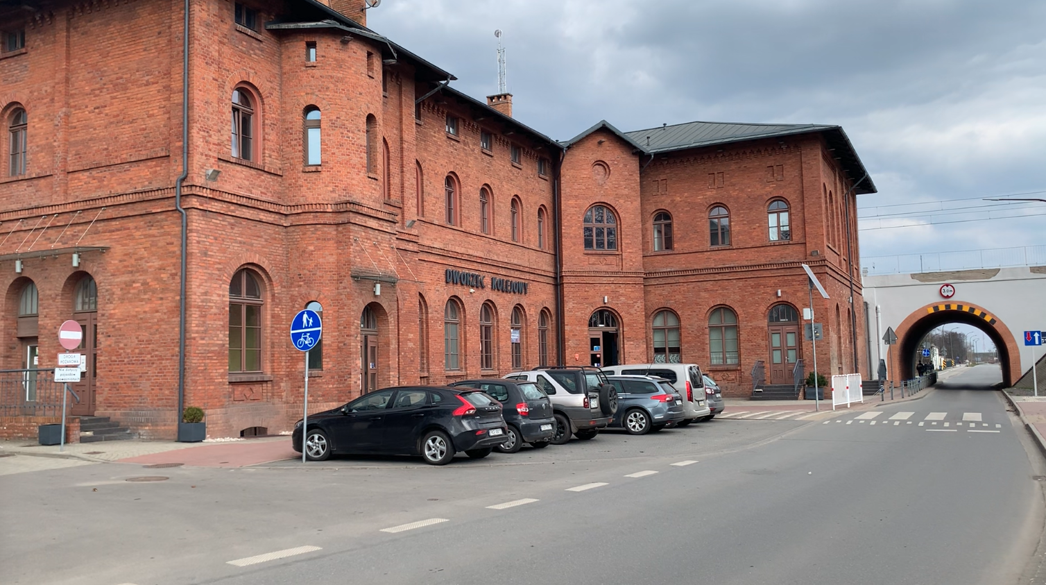
PKP Kępno. 2026
Kępno 2026-04-21 The City of Kępno. Kępno is a small town in the southern part of the Greater Poland Voivodeship, close to the border with Lower Silesia and the Opole region. The city is the southernmost city in Greater Poland. Poznań is 161 km away, Warsaw 260 km away, and Wrocław 76 km away. The…
-
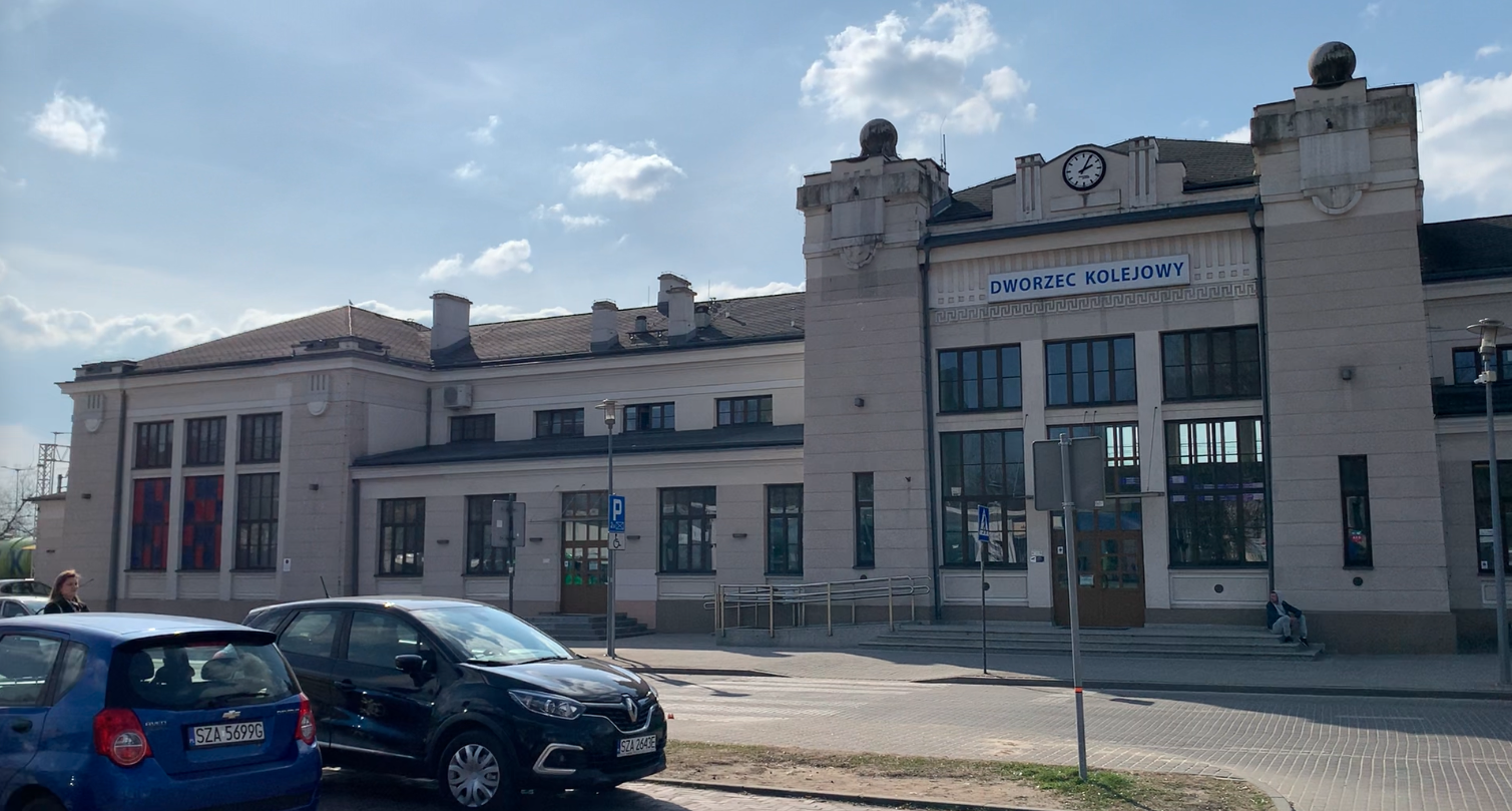
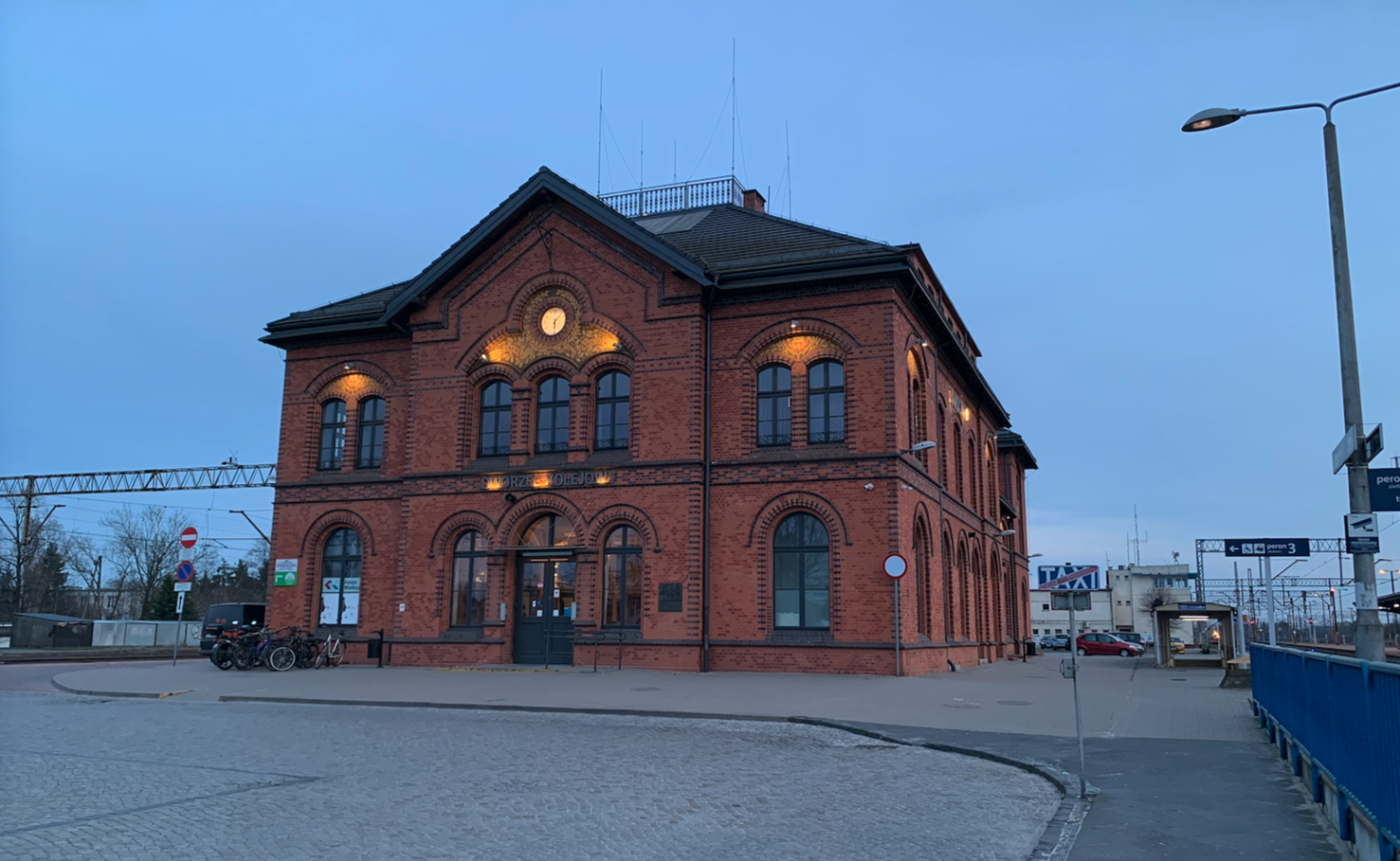
PKP Zawiercie Station. 2026
Zawiercie 2023-04-17 PKP Zawiercie Station. 2026 The Zawiercie railway station building is an interesting example of railway architecture from the early 20th century. It is very representative for a medium-sized town with a population of 46,000. The building is stylish, attractive, and functional. The first station building in Zawiercie was built in 1872. It was…
-
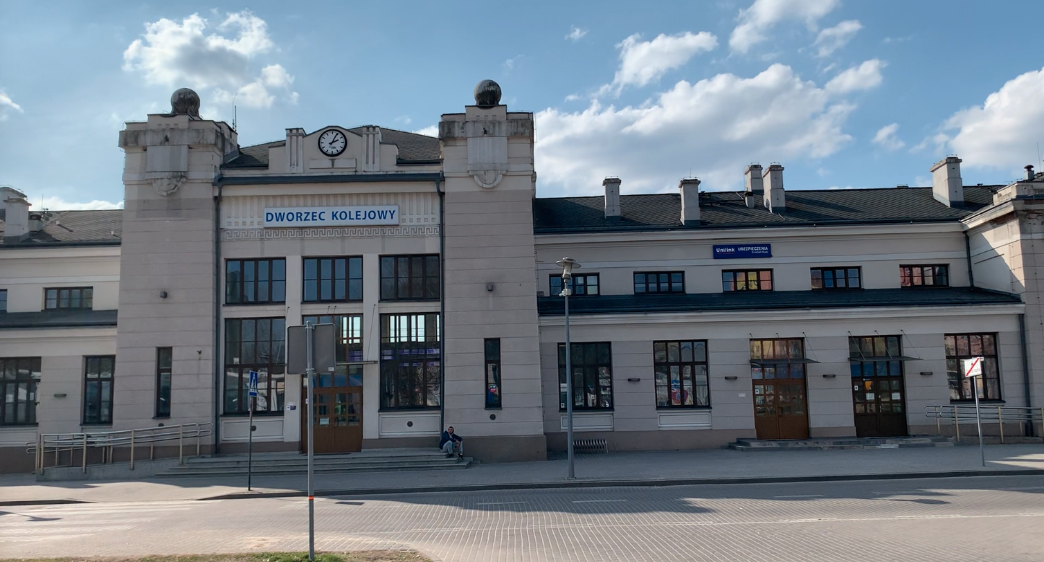
PKP Zawiercie. 2026
Zawiercie 2026-04-17 The City of Zawiercie The city of Zawiercie is called the “Gateway to the Jura.” Numerous hiking trails to the central part of the Kraków-Częstochowa Upland begin here. It is a very green and diverse area, situated on the border of industrial regions and very attractive natural areas. Zawiercie is a peaceful city…
-
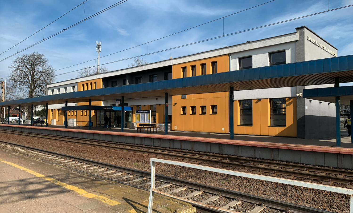
PKP Środa Wielkopolska. 2026
Środa Wielkopolska 2026-04-08 Środa Wielkopolska is a city in central Greater Poland, located just 35 km from Poznań. The city is the county seat and an important local administrative and service center. Środa County. Środa Wielkopolska is a municipality in Wielkopolska. The town has a long history dating back to the Middle Ages. The settlement…
-
PKP Jarocin. 2026
Jarocin 2026-04-04 Jarocin is a city in west-central Poland, in the Greater Poland Voivodeship. The city is the seat of Jarocin County and the Jarocin Commune. In 2021, the city’s population was 26,410, and in 2025, 26,253. The city has an area of 22 square kilometers. Vehicle license plates are PJA. The city is located…
-

PKP Oleśnica. 2022
Oleśnica 2022-03-21 Oleśnica Railway Station. Address: Kolejowa Street 1, 56-400 Oleśnica, Lower Silesian Voivodeship, Poland. Geographic coordinates: 51.201N 17.386E. Elevation: 157 m (515 ft). History of the City of Oleśnica. Oleśnica was undoubtedly a Piast stronghold. From 1294, the town belonged to the Duchy of Głogów. The settlement received city rights on February 22, 1255,…
-
PKP Olsztyn. 2026
Olsztyn 2026-03-03 Olsztyn Olsztyn is the capital of Warmia and Mazury and one of the most important cities in the historical Warmia region. Although Warmia and Mazury are always mentioned together, they are two distinct regions of northeastern Poland. Warmia is Catholic, loyal to the Warmia bishops. There are strong Polish traditions here. Warmia, as…
-
PKP Lidzbark Warmiński. 2026
Lidzbark Warmiński 2026-02-24 Lidzbark Warmiński. Although Warmia and Masuria are always mentioned together, they are two distinct regions of northeastern Poland. Lidzbark Warmiński is a town in the Warmian-Masurian Voivodeship, in Lidzbark County, within the rural commune of Lidzbark Warmiński. Town rights were granted to the settlement in 1308. From 1975 to 1998, the town…
-
PKP Orneta. 2026
Orneta 2026-02-20 Orneta Railway Station. Address: Dworcowa 9, 11-130 Orneta. Geographic coordinates: 54.115N 20.151E. Elevation 70 m. Orneta Station is located in Lidzbark County, Warmian-Masurian Voivodeship. Coordinates: 54°06′53″N 20°09′01″E. Currently (2024), the Orneta station is operated by the PolRegio rail carrier. Three pairs of trains (rail buses) run on the Olsztyn–Braniewo route. Occasionally, tourist trains…