Strzelce Opolskie 2022-04-29
Strzelce Opolskie Railway Station.
Geographic coordinates: 50.517N 18.305E. Elevation 228 m.

The city of Strzelce Opolskie.
Strzelce Opolskie is a city in the Opole Voivodeship in its eastern part. Historically, it belongs to Upper Silesia and lies on the western edge of the Silesian Upland. Strzelce Opolskie has an area of 30.13 km 2. The average elevation is 235 m above sea level. The city has 18,205 inhabitants (2016).
The climate of the region is moderately warm. The average annual temperature is +8.3 degrees Celsius. The average annual precipitation is lower than the national average and amounts to 646 mm.
In the 10th century, these areas belonged to the Slavic tribes of the Ślężanie and were part of the duchy of Mieszko I. The name comes from the Ślęża Mountain. The Ślężanie occupied practically the entire Odra River basin. The main center for the Strzelce Opolskie area was Opole, with the Piast castle. There was a market settlement in Strzelce. Strzelce Opolskie was founded in 1290. In the 14th century, these lands came under the authority of the Czech king. In the 18th century, the whole of Silesia came under the rule of the Prussians.
In the 14th century, the Piast princes built a castle here. In Strzelce Opolskie, the smallest stronghold of the Duchy of Opole, there are ruins of a Piast castle, which was destroyed by Soviet troops during military operations in 1945. A fortified, wooden stronghold stood here even before the city was founded. The main task of the stronghold was to protect the trade routes from Wrocław to Kraków and from the south (Ostrava) to the north (Kalisz). The brick stronghold was built here by Bolesław I of Opole and his son Bolesław II, in the period 1303-1356. Then the Duchy of Opole was divided into districts between the three sons of Bolesław I. The ruler of the small state of Strzelce Opolskie was the youngest son, Albert Strzelecki (+1370). At that time, the stronghold was again granted city rights and was surrounded by walls. As the Czech Kingdom weakened, from 1327 onwards, the dukes of the Opole Land stopped paying homage to the Czech king.
The castle was in the hands of the Piasts until 1532. Then the duchy fell to the Habsburgs. At that time, the castle began to fall into ruin. It was not until the mid-16th century that another administrator rebuilt the castle. In 1615, Strzelce Opolskie became a private town when Georg von Redern bought several estates from the emperor, with the right of inheritance in the male and female lines. From 1651, the Colonna family ruled here for 150 years. In 1759, the Prussian administration imposed a contribution on the town, and the Colonna family’s administrative power was limited. From 1815, the owner of the estate was Count Andrzej Renard, who led the town to prosperity again. In 1820, a paved road from Opole to Bytom was built through the town. In 1840, renovation and reconstruction of the castle began. A castle tower was built. The park was arranged in the English style. The last owner was Count Wolfgang zu Castell-Castell, who in 1932, expanded the estate. He built water and sewage systems. He established baths and toilets.
Before the plebiscite, which was the result of the Second Silesian Uprising, 3,000 Germans were brought to Strzelce Opolskie by train. As a result, on March 20, 1921, the Germans won in the city 85% to 15%, although in the district it was 50.7% to 49.3%, in favor of the Germans. As a result, there was the Third Silesian Uprising, but Strzelce Opolskie remained with the Germans.
On January 21, 1945, the Muscovites entered the city. They destroyed the city, plundered and burned it. They destroyed the castle with cannons. The destruction in the city reached 90%.
The initial name of the town was Strzelce Wielkie. This name appears in Prussian documents from 1750, which were published in Berlin in Polish. The name of the settlement comes from the hunters – princely hunters who organized hunts in the area and protected trade routes. The original name was Germanized by the Germans to Strehlitz and lost its meaning. Then the name Gross Strehlitz appeared. The name is commemorated by the hunter’s monument standing in the market square in front of the town hall since 1929. The stupid Germans started World War II and as a result lost a lot of land, including the town of Gross Strehlitz, which the greats of this world gave to Poland. The Poles changed the name to Strzelce Opolskie. The largest plant in the area was a cement plant, which used a limestone quarry. The plant operated from 1970 to 2005. There was also a 19th century brewery. Currently, there is a furniture factory.
Road transport.
The city is crossed by national road No. 94, and nearby is national road No. 88. The provincial roads are road No. 409 and No. 426. The A4 motorway is nearby.
Rail transport.
Strzelce Opolskie has been connected with the railway since 1878, which is relatively late for the Silesia region. On October 1, 1878, the first freight train on the Opole – Strzelce Opolskie route passed. The train brought rails and railway sleepers for the next sections of the route, towards Upper Silesia. On May 15, 1879, the next section Strzelce Opolskie – Paczyna – Pyskowice was opened. In 1895, a second track was added, which had been planned from the very beginning. On May 15, 1880, the Pyskowice – Bytom route was built and Strzelce Opolskie gained access to Upper Silesia. The Pyskowice – Gliwice Łabędy connection was built later.
The Opole – Strzelce Opolskie – Gliwice railway line is the main line running through Strzelce Opolskie. In 1948, the line had No. 214, and in 1988, it had No. 220, and currently No. 132.
On November 15, 1912, the Strzelce Opolskie – Fosowskie line was launched through: Rozmierka, Kadłub, Sporok, Staniszcze Wielkie. This is a line towards the north, which leads to Kluczbork.
In the period 1934 – 1936, a railway line was built towards the south; Strzelce Opolskie – Kędzierzyn-Koźle through: Zima Wódka, Zalesie Śląskie, Leśnica, Łąki Kozielskie.
In 1948, the Fosowskie – Strzelce Opolskie – Kędzierzyn-Koźle line was merged into one line and had No. 215, and in 1988, No. 161. Currently (2022) the Strzelce Opolskie – Kluczbork line has No. 175. The Strzelce Opolskie – Kędzierzyn Koźle line is currently not used.
In the 90s, at the Strzelce Opolskie station, as a result of the liquidation of workplaces, the railway sidings to them were liquidated. Among others, the siding to the plant, which is now the Transport Company of Self-Driven Cranes at 1 Maja Street. The railway tracks to the cement plant and quarry at Marka Prawego Street were liquidated. Passenger rail connections in the north-south direction were liquidated.
Electrification.
On October 3, 1960, the Wrocław – Gliwice route via Pyskowice, Strzelce Opolskie and Opole was electrified. On July 11, 1984, the Strzelce Opolskie – Fosowskie route was electrified.
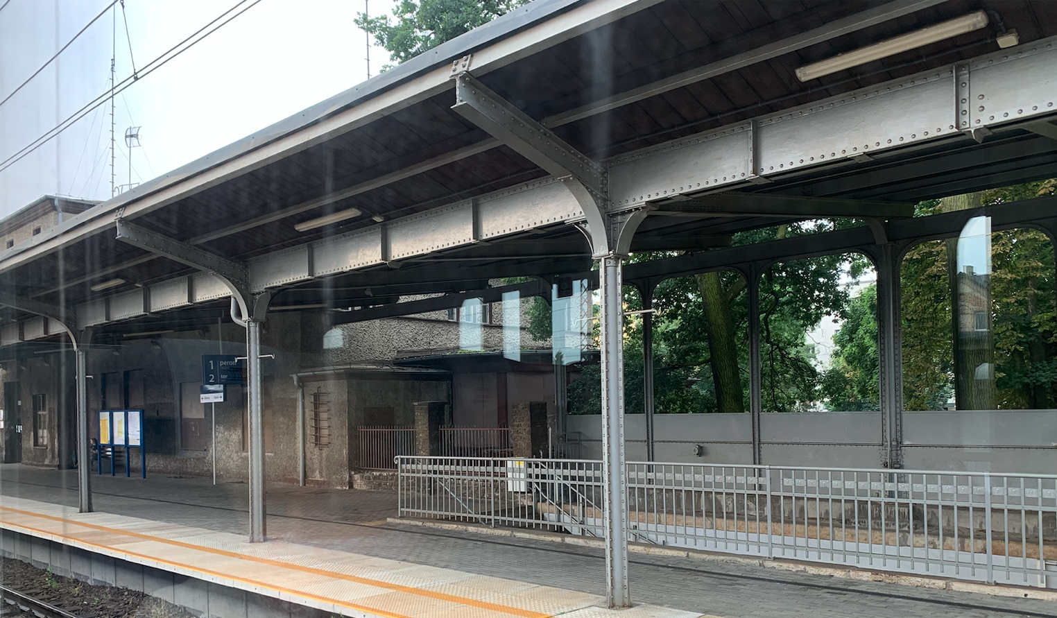
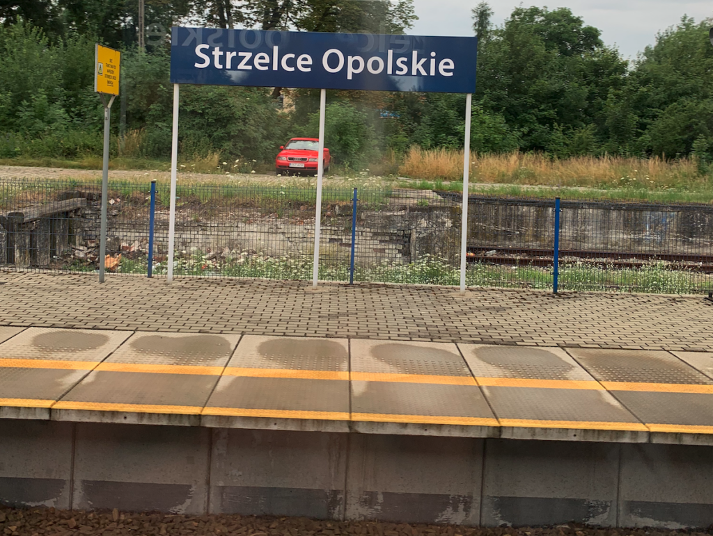
The station in Strzelce Opolskie.
The first station was built in 1880. The new station was built in 1935, and it closely resembled the old station. In the 90s, as a result of the reduction in rail transport, the station began to decline. The waiting room, public toilet and luggage storage were closed.
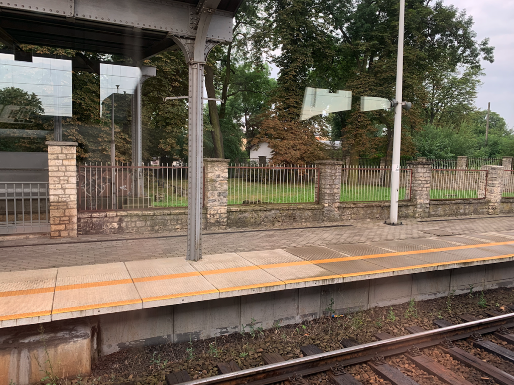
In the period 2013 – 2015, the Strzelce Opolskie railway station was renovated. The platforms, shelters, underpass, and track system were renovated. The speed of passenger trains was increased to 120 km/h, and that of freight trains to 100 km/h. The renovation was completed in May 2015. The renovation resulted in an increase in the number of long-distance passenger trains of TLK and InterCity carriers, at the expense of Kędzierzyn-Koźle. The station itself is open, there are two ticket offices, a few seats for passengers. There is a light board with railway information. There is a lack of a waiting room, a buffet and toilets.
Strzelce Opolskie railway station is located on the important C-E30 railway route, which runs from Germany through Poland to Ukraine. Currently (2022), Strzelce Opolskie station serves InterCity and PolRegio passenger trains. In 2018, the station served up to 900 passengers per day. There are three platforms at Strzelce Opolskie station. Platform 1 is single-edged. It was 250 m long, and after renovation it is 200 m long. Platform 2 is an island, it was 200 m long, and after renovation it is also 200 m long. Platform 3 is also an island. It was 180 m long, and after renovation it is also 200 m long. It is the narrowest platform. Passenger trains that end or start their run in Strzelce Opolskie stop at Platform 3. The length of the platforms of 200 m means that not all InterCity trains fit within the platform gauge during the summer season. But this is not a big problem. The passage under the platforms was built around 1935. There are 10 tracks at the station and several additional impassable tracks.
Railway traffic is serviced by two signal boxes. The “SOe” signal box is located in the eastern part of the station, at the top of Platform 2. The “SOe1” signal box is located in the western part of the station, by the viaduct along Habryki Street, on the northern side.
There was also a small two-station locomotive shed at the station (without a turntable). It was located in the eastern part of the station, at Jana Matejki Street. There was also a water tower here. Loading yards, warehouses and loading ramps are located in the southern part of the station, west of the station.
Kamień Śląski Airport.
The distance between the airport in Kamień Śląski and the railway station in Strzelce Opolskie is 19 km. The airport is west of the city. The airport is described in a separate chapter.
Written by Karol Placha Hetman