Knurów 2025-06-21
Knurów Railway Station.
Geographic coordinates: 50.217N 18.688E. Elevation 246 m.
City of Knurów.
The town of Knurów was founded in 1295. City rights were granted in 1951, already in the Polish People’s Republic. Currently, the city belongs to the Silesian Voivodeship and is located in the Gliwice district. Currently, the city has an area of 33.95 km2, and the population is 35,899 inhabitants, in 2022.
Knurów is located in the southern part of Poland, in the Silesian Voivodeship, in the southern part of the Gliwice district. In the period 1975-1998, the city administratively belonged to the Katowice province. The distance to Gliwice is 10 km, to Katowice is 31 km, to Warsaw is 315 km. The city belongs to the Katowice agglomeration and belongs to the Upper Silesian Industrial Region. Knurów is located on the Silesian Upland. The city has many green areas and a good hydrological system. The largest lake in the city is Staw Moczury. The highest elevation of Knurów is the hill in the north-eastern part of the city, with an elevation of 265 m. The major problems of the local areas are sinkholes, swamps and ponds. This is the effect of ground subsidence caused by the exploitation of hard coal. The largest mines are KWK Knurów and KWK Budryk. Green areas are mainly mixed forests. Coniferous forests constitute 61.5%, and deciduous forests 38.5% of their total area.
The first mention of Knurów comes from the “Book of Endowments of the Bishopric of Wrocław”, established around 1295. The oldest documents from 1305 and 1447 show that the area around Knurów territorially belonged to the Gliwice Land, originally the Kingdom of Poland, then the Kingdom of Bohemia, and later the Austrian Habsburg Monarchy. These areas were poor and sparsely populated. Changes were brought by the industrial revolution. Large deposits of hard coal were discovered in this area. Knurów transformed from a typical rural settlement into an industrial center. Most of the inhabitants were Polish-speaking. The dynamic development of mining and the growing demand for gunpowder contributed to the establishment of the first gunpowder factory in Krywałd in 1875. Currently, the only traces of the former plant are the impressive management building. In 1850, there were 143 households (smokestacks) in the town, inhabited by 776 people. In 1880, large deposits of hard coal were discovered in the area. A decision was made to build a large hard coal mine and a coking plant. As a result, in the period 1900-1921, four colonies of single-family houses were built, inhabited by officials and miners. These colonies were characterized by regularity and geometric layout. The layout of these colonies has been preserved to this day, with elements of rural farms, different from the rest of the later city. The accompanying infrastructure was gradually built: a post office, school, shops, bakery, shoemaker’s workshop, tailor’s workshop, forge and saddlery workshop. In 1912, the Bracka Company Hospital was established (currently the city hospital on Niepodległości Street). After the Great World War, several modernist tenement houses were built. In the period 1928-1929, the city hall was built.
In 1908, the first standard-gauge railway line was launched.
In the period 1919-1921, many residents of Knurów took part in the Silesian Uprisings. The uprisings were associated with Germanic terror against the Polish population. During the plebiscite, the majority of Knurów residents voted to annex this part of Silesia to Reborn Poland. After the formation of the border in Upper Silesia in 1921, Knurów, Szczygłowice and Krywałd found themselves within the borders of Poland already in 1922. From that time on, Knurów was part of Poland, but it became a border town, because the border with the Germans ran nearby. Polish Army units arrived in Knurów. Crowds of Polish people flocked here, who found employment in industry and mining, and as a result the population of the town grew significantly. Although Knurów was not a city, a town hall was built.
Already on September 1, 1939, Germanic troops entered Knurów from the direction of Szywałd. The Polish Army and former Silesian insurgents took part in the fight. During the fighting, four Polish soldiers died, including commander Feliks Michalski, whose monument can be seen at the Municipal Primary School No. 3 on Michalskiego Street. After the lost defensive war, Germanic terror began, supported by Volksdeutsche and informants. All underground soldiers were shot.
On January 26, 1945, the Soviets entered Knurów and communist terror began. In 1951, Knurów received city rights. The post-war period brought further development to the city, associated with the expansion of industry and the launch of a second mine in Szczygłowice in 1961. New groups of the Polish population arrived in the city, which resulted in further dynamic development of the industry and the city. New housing estates were built. On March 8, 1990, a local government was established in Knurów. The city has a list of monuments and many buildings are under the care of the conservator of monuments; the city hospital, the town hall, the parish church, the Knurów Coal Mine management building from 1912 and others. The city has a coat of arms, a flag and a bugle call. Currently, the Knurów-Szczygłowice Coal Mine is the largest employer in the region, employing about 6,000 people.
Currently, Knurów is very well connected. The A1 motorway runs along the eastern border of the city, and the national road No. 78 on the western side. In turn, to the north, at a distance of about 5 km, the A4 motorway runs. The following roads run through the city itself: national road No. 921 and 924.
Knurów railway station.
Geographic coordinates: 50.217N 18.688E. Elevation 246 m.
The Knurów railway junction consists of: Knurów railway station, Knurów Kopalnia (Knurów Szpital) passenger stop, Knurów Szczygłowice (closed railway station), Szczygłowice branch station, Szczygłowice Kopalnia.
Knurów Kopalnia (Knurów Szpital) is a passenger stop that was built in 1965. The stop is located close to the city center, which makes transport easier for residents. There was a station building with a ticket office and waiting room and two platforms. It was used by young people commuting to Rybnik secondary schools and to the Knurów Mining School, miners of the Knurów and Szczygłowice Coal Mines, as well as employees of the “Silesia” steelworks, the Rybnik Machine Factory “Ryfama” and other workplaces. The stop is crossed by LK Nr 149 Zabrze Makoszowy – Leszczyny. There were two platforms and two platform edges at the stop. In the 70s, 12 pairs of trains stopped at the stop. The station was closed to passenger service on October 30, 1998, and at the same time the ticket office, waiting room and utility point were closed. In the period 2020-2025, a new stop called Knurów Szpital was built in the place of the former stop.
Knurów Szczygłowice is a disused station that was built in 1909, on LK Nr 149 Zabrze Makoszowy – Leszczyny. In 1999, passenger trains stopped stopping at the station. The station building was demolished.
Szczygłowice branch station, which was opened in 1909. There are railway lines here: LK No. 149 Zabrze Makoszowy – Leszczyny. LK No. 219 KWK Szczygłowice – Nieborowice. LK No. 859 Szczygłowice Kopalnia – KWK Szczygłowice.
Szczygłowice Kopalnia is a former passenger stop opened in 1909. The stop was closed in 1995. The stop is located on LK No. 149 Zabrze Makoszowy – Leszczyny.
The most important reason for the construction of a railway line through Knurów was the construction of a Coal Mine in Knurów by the Prussian state treasury. The coking plant that was to be built joined this project. The main purpose of the construction of the line was to transport coal and coke to Austria. Railway lines in Silesia had belonged to the Prussian state since 1884. The route design was created in 1905, which connected the Gierałtowice station with Orzesze. On July 15, 1908, a 6-kilometer section of the railway was opened, connecting Knurów with Gierałtowice, and on October 1, 1909, the route leading from Knurów to Rzędówka via Szczygłowice, 11 kilometers long, was connected. At first, the entire line from Rzędówka station to Gierałtowice (running through Knurów) was single-track, but the large number of transports decided to build a second track. Knurów station was launched as a Class III station, to handle freight traffic. However, postal and passenger traffic was quickly launched here.
The railway line to Knurów was electrified in 1986. The railway crisis of the 1990s caused the closure of many railway connections. This degradation also affected Knurów station and all its stations and passenger stops. In 2001, passenger traffic was completely suspended. In 2009, the bridge over the Bierawka River in Szczygłowice collapsed on LK No. 149. It was renovated and put back into use in June 2014. As a result of the renovation of the LK No. 149 track, which was carried out in stages, in the period 2014 – 2018, passenger traffic returned. After an 18-year break, on December 9, 2018, together with a new timetable, a weekend connection was launched on the Gliwice – Wisła Głębce route. It was the “Kubalonka” train. Then, holiday trains to Bohumin, Kołobrzeg and Zakopane stopped at the station. In 2022, passenger exchange included up to 10 travelers per day.
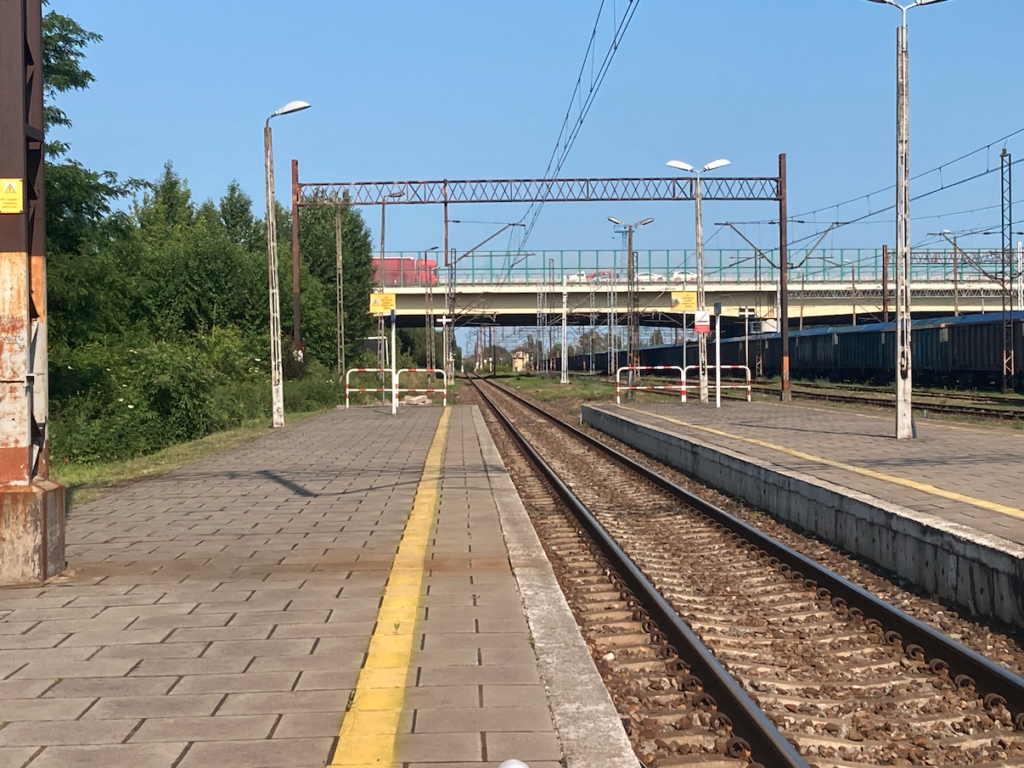
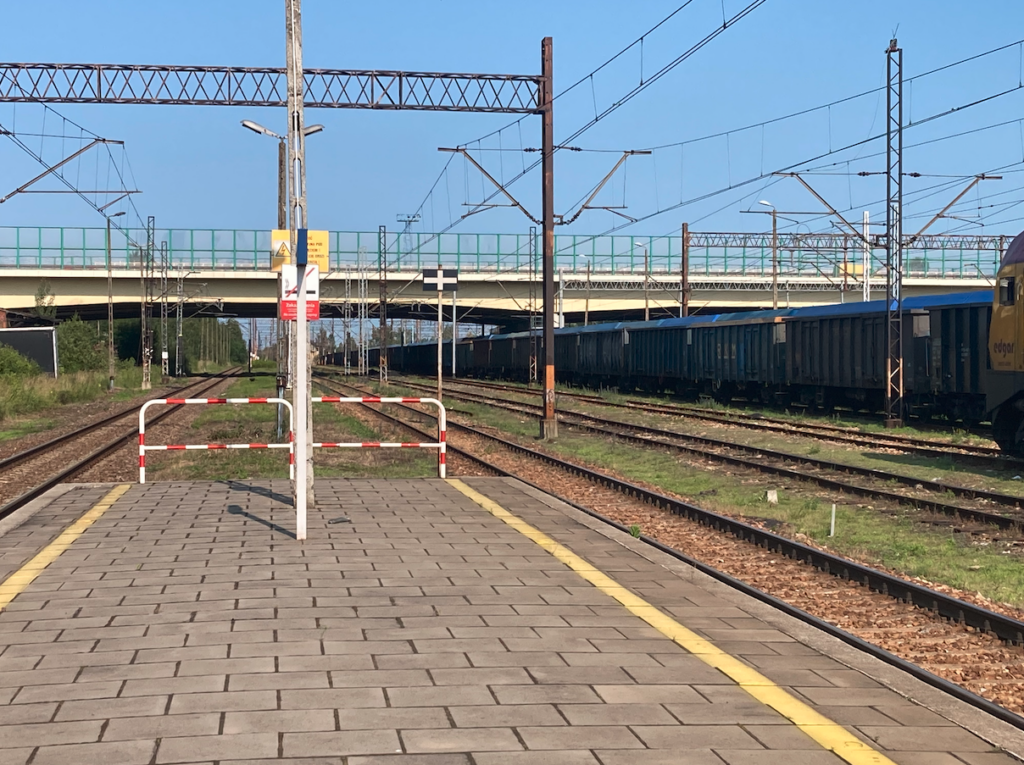
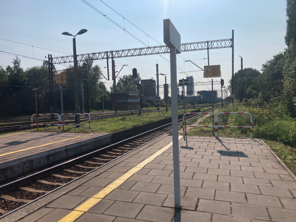
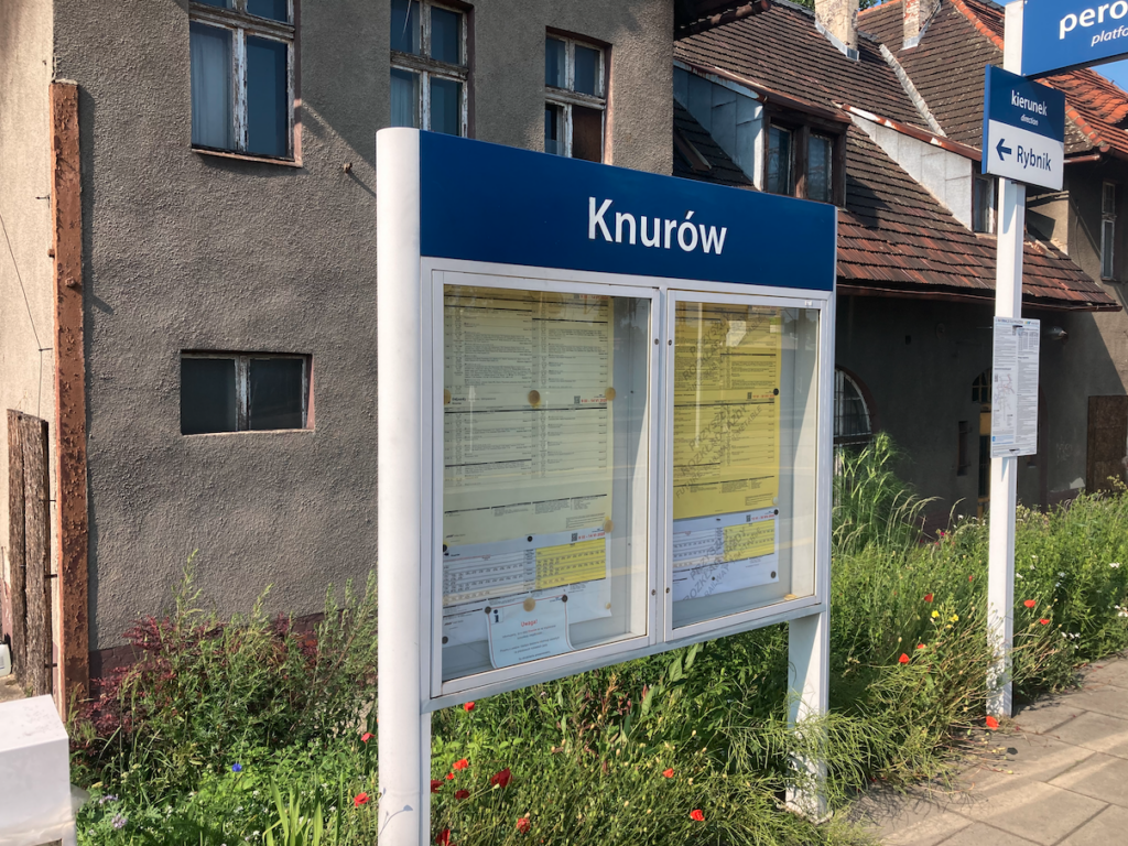
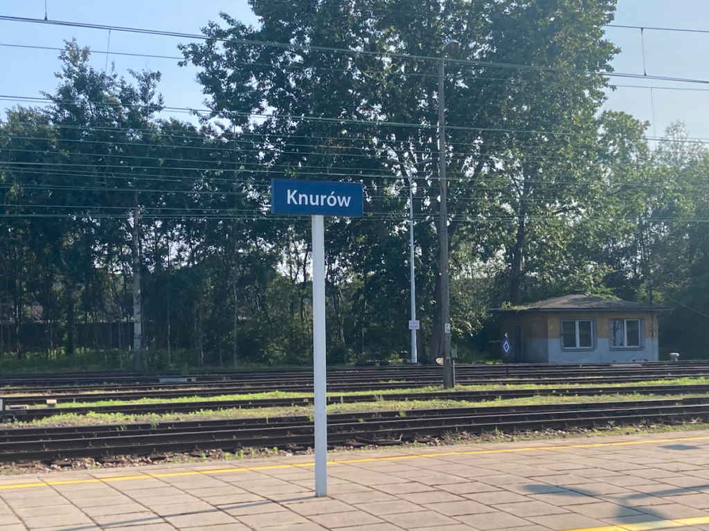
The railway station in Knurów has two platforms and three platform edges. The renovated platforms are 100 m long, although they were previously much longer. Access to the platforms is at the level of the tracks. There has never been a footbridge or underpass at the station. Intensive actions by local government officials resulted in Knurów returning to the railway map of Poland a few years ago, where passenger connections are provided. The platforms were modernized, and soon the expected Silesian Railways train services were launched. Currently, 18 trains depart from the Knurów station daily (June 20, 2025). In June, it was possible to travel to the following stations: Gliwice, Racibórz, Rybnik, Wilkowice Bystra, Wisła Głębce, Wodzisław Śląski.
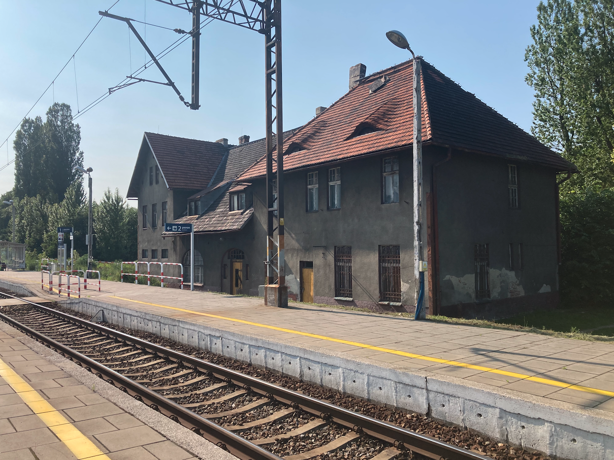
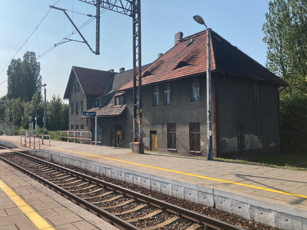
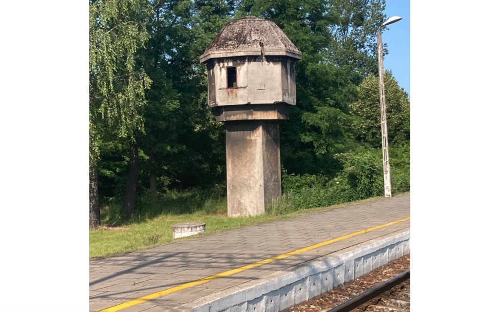
The station building was built in 1908. The station is a multi-body structure. Its two high parts have three storeys. The middle part, where the ticket office and restaurant were located, is ground floor with a developed attic. The building had a ticket and luggage office, a small shop, and the stationmaster’s apartment. Currently, the station is mainly used to service freight trains, preserving part of the original interior. Currently (2025), negotiations are underway regarding the takeover of the station building by the city of Knurów. The building is listed in the municipal register of monuments. The negotiations also include the historic water tower.
There is a relatively small water tower at the station, with a characteristic concrete structure. Nearby are railway buildings that housed railway service offices and a medical clinic. There are light semaphores at the station. Railway traffic at the station is serviced by signal boxes: “KnK”, “Kn”, “Kn1”, There are two railway lines at the Knurów station: LK No. 149 Zabrze Makoszowy – Leszczyny (11.87 km of line) and LK No. 863 Knurów – KWK Budryk. The A1 Amber Motorway runs above the station track.
To the south of the station is the Knurów Coal Mine, and behind the mine are the dumps of the Knurów and Budryk mines. To the north of the station is a town that grew to the north-west.
Written by Karol Placha Hetman