Kielce 2025-09-20
Railway line No. 61 Kielce Główny – Fosowskie.

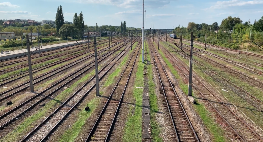
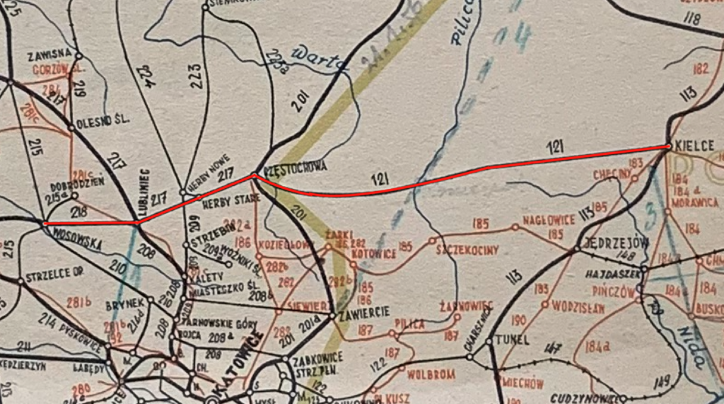
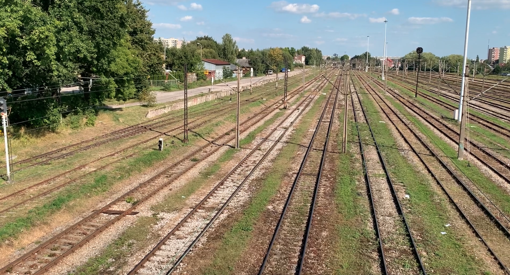
Railway line No. 61 Kielce Główne – Fosowskie is 177.300 km long. The line runs meridionally, from east to west. The line is electrified with 3 kV DC. The maximum speed is 160 km/h. The line is double-track, and from Lubliniec station it becomes single-track.
The line was built in stages and initially belonged to the Moscow Partition and the Prussian Partition. The line was established as the Herbsko-Kielecka Railway, although this name has no historical justification, because the line connected Kielce with Lubliniec, via the stations of Włoszczowa, Koniecpol, Częstochowa, and Herby. No company or company called Herbsko-Kielecka was established. Individual sections have different origins, different investors, and even different track gauges: narrow gauge, standard gauge, and broad gauge. The line was intended to carry freight and passenger traffic from Częstochowa (Warsaw-Vienna Railway) westward to the Prussians. From 1854, initially, a connection between Granica and Mysłowice, as well as Częstochowa and Herby Pruskie, was considered. The cheaper option won; The border (Maczki) – Mysłowice. However, the second proposal also attracted widespread support. It allowed for a significant shortening of the route from Warsaw to Lubliniec, Opole, and Wrocław. However, this investment was blocked by the Tsarist regime in Moscow. However, Prussian shareholders in the Warsaw-Vienna Railway contributed their own funds to build the Herby – Częstochowa line. These shareholders were also shareholders in the Prussian Right-Oder Railway. In 1867, these shareholders submitted an application for the construction of this line. Furthermore, the shareholders promised to take over all freight traffic between the Kingdom of Poland and the Prussians. When the line was built, it turned out that the Right-Oder Railway Company had doubled its profits. During this time (1859), a connection was also established via the Ząbkowice and Szopienice stations.
Obtaining the consent of the Tsar of Moscow, on June 16, 1869, the general assembly passed a resolution to begin construction of the Częstochowa-Herby line. No completion date was given because, according to law, the line would be purchased by the Muscovites after 30 years.
On December 1, 1891, the Lubliniec-Herby Pruskie section was completed. In 1903, the narrow-gauge Herby Ruskie-Częstochowa section was built. On October 10, 1894, the Lubliniec-Fosowskie section opened. In 1905, the Prussians built the Herby Pruskie-Herby Ruskie section with standard gauge. In 1911, the Częstochowa-Stradom-Kielce section with broad gauge was built. At the same time, the Częstochowa-Stradom-Herby Ruskie section was converted to broad gauge. It’s worth mentioning that the Częstochowa-Kielce line was initially intended to run through Olsztyn near Częstochowa and Złoty Potok near Janów. Work was planned to be completed in 1910. The entire Herby-Kielce section from Moscow was finally opened on February 26, 1911.
When the Great War broke out, a turning point occurred on the front line, and the Muscovites began to retreat, the Prussians converted the tracks from broad gauge to standard gauge. After the Great War and the rebirth of the Polish Republic, the railway line from Kielce to Lubliniec inclusive was placed under the management of the Polish State Railways (PKP). Three railway lines branched from Lubliniec to Kluczbork, Opole, and Pyskowice, each of which reached the German border after approximately 10 km. The customs war brought traffic on these lines to a complete standstill.
Electrification. On November 27, 1965, the Częstochowa Stradom–Liswarta section was electrified. On April 29, 1967, the Kielce–Kielce Herbskie section was electrified. On January 26, 1973, the Liswarta–Lubliniec sections were electrified, and on December 29, 1973, the Koniecpol–Częstochowa Stradom sections were electrified. On December 4, 1974, the Kielce Herbskie–Koniecpol section was electrified. On December 18, 1976, the Lubliniec–Fosowskie section was electrified.
Preparations for the final renovation of the route had been underway since 2010. In May 2012, a tender was announced for the renovation of the Koniecpol–Turów section (74.887–99.679 km). The tender was awarded in August 2012. In mid-January 2013, a tender was announced for the remaining work on the Częstochowa – Koniecpol section. PLN 136.1 million was allocated for the renovation. The contract was signed in mid-April 2013. As part of the renovation, 40 km of track, including the trackbed, was replaced. 33 level crossings were rebuilt. 27 engineering structures, including bridges and culverts, were repaired. Traffic control devices, the overhead lines, and platforms at stations and stops, including lighting, were replaced.
In May 2012, a tender was announced for the renovation of the Częstochowa – Fosowskie section. On March 25, 2013, a contract was signed with Przedsiębiorstwo Napraw i Utrzymania Infrastruktury Kolejowej (a railway infrastructure repair and maintenance company) in Kraków. The contract value was PLN 323.49 million.
Additionally, renovations were carried out on the Lubliniec – Opole Główne route, which includes LK No. 61 and LK No. 144. The work was estimated at PLN 109 million. The contract was signed on February 1, 2013, and completed on November 28, 2014. The scope of work included the replacement of 31 km of track, the repair of 25 level crossings, and the renovation of 24 bridges and culverts. The work was finally completed on August 18, 2014.
Currently (2025), the entire line is electrified. In 2007, the Częstochowa Gnaszyn – Jawornica section (a suburb of Lubliniec) was renovated. The renovations allowed train speeds to be increased to 120 km/h. The Kielce – Herby – Lubliniec route is important for both freight and passenger traffic. The section from Częstochowa westward is the most congested.
Railway line No. 61 Kielce Główne – Fosowskie. Route.
Kielce Główne station (0.00 km, elevation 266 m). Line No. 61 begins at Line No. 8 Warsaw – Kraków. The line heads north and turns west. It crosses 1 Maja Street twice.
Kielce Herbskie marshalling yard (2.25 km, elevation 280 m). There is a connecting line No. 567 here. Two pedestrian bridges over the station.
Kielce Ślichowice passenger stop (3.72 km, elevation 280 m). The stop is within the Kielce Herbskie station. The name comes from a quarry. The line then runs above Malików Street. The line has three tracks, but previously had five tracks, to the planned new freight station. The line turns southwest. The line crosses the Sufraganiec River. The line turns west again and runs along the northern side of DW No. 786.
Szczukowice is a passing loop (7.40 km, elevation 249 m).
Szczukowskie Górki is a passenger stop, LCS (8.17 km, elevation 247 m). The line passes under the S7 motorway and crosses the Bobrza River. Further on, there is an intersection with a local road, and then the line passes under DW No. 786.
Szczukowice is a junction (10.74 km, elevation 255 m). Line No. 568 Sitkówka Nowiny – Szczukowice branches off here.
Piekoszów is a passenger stop (11.37 km, elevation 261 m). There are two single-edge platforms here.
Jaworznia Quarry is a dismantled siding (12.08 km, elevation 267 m). Further along, the line intersects with DW No. 761, Częstochowska Street, and Chęcińska Street. This area is agricultural land.
Piekoszów Łaziska passenger stop + loading bay (km 14.01, elevation 270 m). There is one island platform here. Further on, the line crosses local roads three times with intersections.
Rykoszyn station (km 19.01, elevation 247 m). A large freight station with sidings to local plants, including “Zakład Miedzianka” (Miedzianka Plant). There are two single-edge platforms. Further on, the line crosses local roads five times with intersections.
The Snochowice gravel pit was a siding (km 23.02, elevation 229 m). The line crosses the Wierna Rzeka river.
Wierna Rzeka passenger stop (km 23.73, elevation 231 m). There are two single-edge platforms here. The line frequently changes direction and enters forests.
Małogoszcz, a large station (km 27.30, elevation 233 m). There is a siding to the large Małogoszcz cement plant. There is one island platform here. Voivodeship Road No. 728 passes over the station on a viaduct.
Bukowa, a passenger stop (km 32.41, elevation 267 m). There are two single-edge platforms here. On the south side is the Bukowa Lime Plant, to which a siding runs from Małogoszcz station.
Ludynia, a station (km 36.69, elevation 280 m). The station is located in the village of Czostków. There is one island platform here. There are three further intersections with local roads.
Ludynia, a passenger stop (km 40.33, elevation 264 m). There are two single-edge platforms here. Ludynia; there is a wooden manor house in the village, south of the train stop. Borowisko former passenger stop (43.32 km, elevation 245 m).
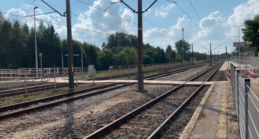
Włoszczowa station (km 47.73, elevation 250 m). The station is nestled among forests. There are three platform edges, including one island platform. Beyond the station is an intersection with DW No. 742. Further on, the line crosses two local roads.
Czarnca passenger stop (km 53.03, elevation 250 m). Before the stop is an intersection with DW No. 786.
Czarnca junction (km 53.26, elevation 250 m). Railway lines No. 571 and 582. This is a connection to CMK. On September 2, 2023, with the opening of the Czarnca – Włoszczowa Północ link, regional and express train traffic between the Czarnca junction and Żelisławice station was suspended, taking the shortest route, i.e., line No. 61.
Żelisławice station (59.71 km, elevation 238 m). Line No. 572, to the Central Main Line. There are three platforms here. The line then crosses the Zwiecza River. There are forests and artificial reservoirs here.
Teodorów was a passing loop (64.27 km, elevation 238 m). The Świętokrzyskie/Silesian Voivodeship border (65.24 km).
Koniecpol station (71.47 km, elevation 239 m). Line No. 64 Kozłów – Koniecpol. The station has three platform edges. There is a pedestrian bridge over the tracks. The line then crosses the Pilica River.
Koniecpol Centrum passenger stop (km 73.46, elevation 235 m). There are two single-edge platforms here. Between them is the intersection of DW No. 794 and Juliusza Słowackiego Street.
Koniec Magdasz passenger stop (km 74.88, elevation 234 m). There are two single-edge platforms here. Between them is the intersection with Wiejska Street. Further on is the intersection with Kościelna Street.
Podlesie passenger stop (km 78.50, elevation 238 m). There are two single-edge platforms here, opposite each other. There is the Podlesie “Pd” signal box. Further on is the intersection; Główna Street.
Staropole Częstochowskie passenger stop (km 83.33, elevation 247 m). There are two single-edge platforms here, opposite each other. This area is agricultural land. Before the next station, the line crosses the Wiercica River and the Zalesie Reservoir, passing the intersection with DW No. 793.
Julianka station (km 87.88, elevation 245 m). There are three platform edges here. The station features a monument dedicated to the victims of the rail accident of November 3, 1976. The line then passes through forests.
Lusławice passenger stop (km 94.00, elevation 269 m). There are two single-edge platforms opposite each other.
Turów station (km 99.67, elevation 299 m). There are three platform edges here. There is an intersection with Olsztyńska and Świerkowa Streets. Further on, there are three intersections with local roads.
Kusięta Nowe passenger stop (km 104.13, elevation 293 m). There are two single-edge platforms opposite each other. The line passes through the Eagles’ Nests Landscape Park.
Kusięta former sectional gate (km 104.86, elevation 287 m). This is where a large railway junction begins; Częstochowa.
Kusięta passenger stop (km 107.44, elevation 266 m).
Kucelinka “Ku” junction (km 110.25, elevation 257 m). Lines No. 155, 701, and 703).
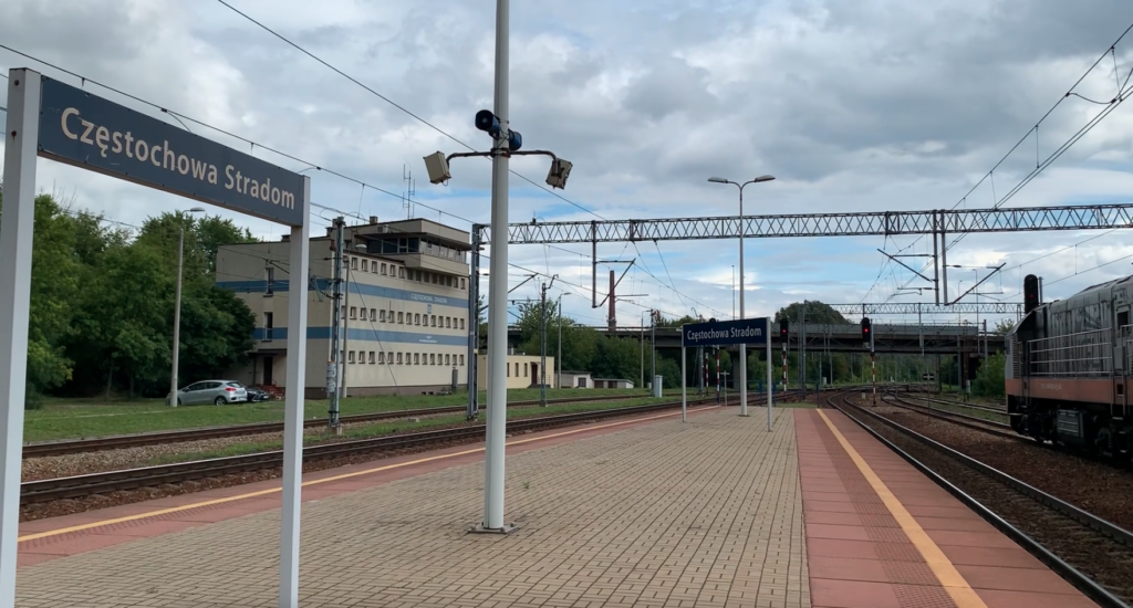
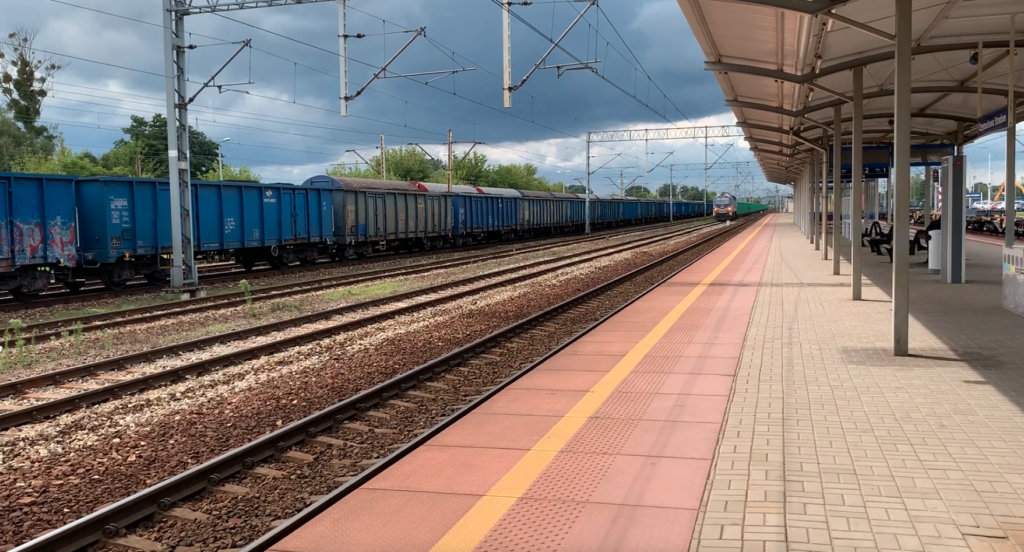
Częstochowa Stradom station (km 117.22, elevation 249 m). This is where the Częstochowa junction ends. The station has two platforms and three crossings. National Road No. 46, Bohaterów Monte Cassino Avenue, crosses the tracks in front of the station. Nearby is the Częstochowa Stradom “CS” Interchange. The Stradomka River flows parallel to the station on the south side. Behind the station is an intersection; Zaciszańska Street. The line runs alongside National Road No. 46; Główna Street. The line crosses three intersections with local streets: Przestrzenna, Mała Warszawka, and Torowa.
Częstochowa Gnaszyn station (km 122.907, elevation 264 m). There is one island platform here. It is a small freight station. Further on, the line crosses the Stradomka River. The upper line passes over Kolorowa Street. There is an intersection with Szybowa Street. The line then passes over the motorway exit roundabout and, a little further on, runs under the A1 motorway. The Konopiska mine was a siding (km 124.24, elevation 266 m).
Blachownia station (km 127.77, elevation 272 m). There are two single-track platforms here. There is an intersection with Pocztowa Street. The station has six through tracks. On the northern side of the line, it still accompanies national road no. 46. The line enters the Forests on the Upper Liswarta Landscape Park. Behind the station is an intersection with DW No. 904. The line crosses the Trzepizurka River. There is an intersection with Piękna Street.
Herby Stare station, former location (km 133.50, elevation 280 m). Lines No. 61, 687, and 704. Currently, this is the eastern part of the station, which is not in use, and the old tracks have been dismantled. It was the border between the Muscovites and Prussians (km 134.16). Herby Stare station (km 134.66, elevation 286 m). Railway lines No. 687 and 704. There are two platforms and three platform edges. The station has an intersection with DW No. 905. Behind the station is a railway junction connecting to the “Coal Main Line.”
Liswarta branch line “Lsw” (km 138.61, elevation 268 m). Line No. 686. Ahead of us on the line are four historical sites associated with line No. 61h. The line crosses the Liswarta River.
Lisów station (km 141.79, elevation 264 m). There is one island platform here. Before the station is the intersection with Gustawa Morcinka Street, and after the station, Stawowa Street crosses the line overhead. Further on are the intersections with Krawieńca, Szkolna, Rolna, and Wiejska Streets.
Kochanovice station (km 145.84, elevation 281 m). There are two platforms and four platform edges here. A siding to a feed factory branches from the station. Further on, the line crosses Podlesie Street and DW No. 906 (Powsców Śląskich Street) at the intersection. The Lubliniec junction begins. Jawornica branch post “Lw” (149.84 km, elevation 264 m). Line No. 685. The line crosses the Lublinica River.
Lubliniec station (152.23 km, elevation 260 m). Railway lines No. 61i, 61j, 143, and 152 run above the station. The station has two platforms and four platform edges. From Lubliniec station, LK No. 61 is single-track, leaving northwest and turning west. It intersects with Częstochowska, Zwycięstwa, Opolska, Księdza Kardynała Stefana Wyszyńskiego, and Zachodnia streets. The line then passes under DK No. 11 and 46. Lipie Śląskie was a station (155.64 km, elevation 265 m). Line No. 61j.
Lisowice passenger stop (156.68 km, elevation 259 m). Further along are intersections with Adama Mickiewicza Street, Juliusza Słowackiego Street, Lubliniecka Street (DK No. 46), Napłatki Street, and Zawadzkiego Street.
Pawońków station (km 161.22, elevation 243 m). There are two single-edge platforms here. The line then runs through forests again. This is the former border with the Germans (1918-1939).
Pludry station (km 168.44, elevation 218 m). There are two single-edge platforms here. Before the station is an intersection with Aleja Wyzwolenia Street (DW No. 901). A large railway sleeper impregnation plant operates at the station. Further along, the line crosses the Bziniczka River. Then, there are intersections with Leśna Street and Opolska Street (DW No. 463).
Fosowskie station (km 175.73, elevation 197 m). Lines No. 144, 175, and 338. The southbound and northbound lines are closed. The station has four platforms. The station has a very interesting track layout. The station is located at a fork in the track (line).
Written by Karol Placha Hetman