
Warszawa 2026-01-30
Railway line No. 3 Warsaw West – Kunowice. 2026.
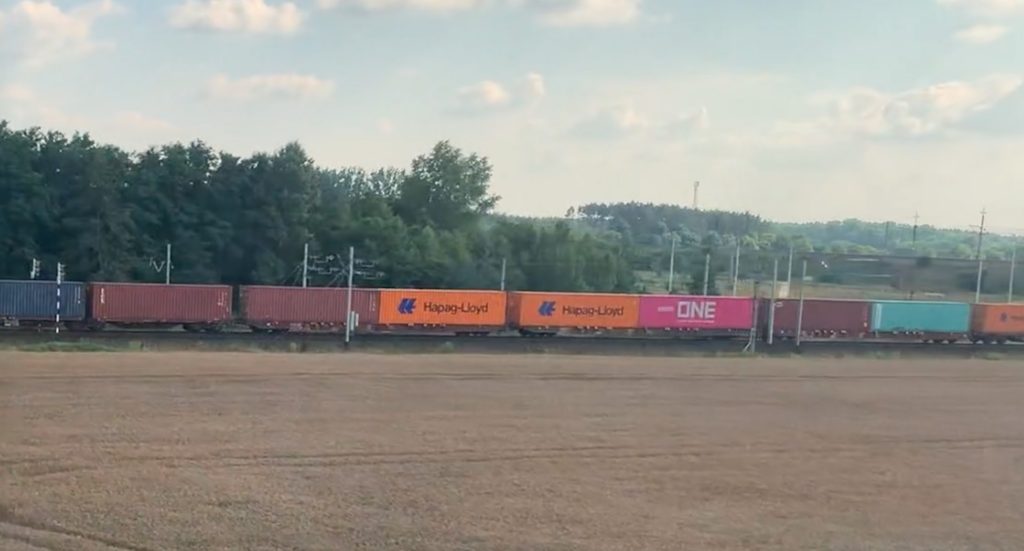
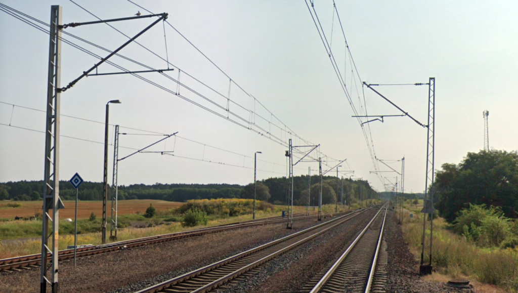
Railway line No. 3 is one of the most important and longest railway routes in Poland, with significant both national and international significance. This route is sometimes referred to as the Warsaw-Berlin line. But it is clearly not a friendship trail, but rather a symbol of the attempted Germanic domination of the Polish nation. In international transport, LK No. 3 is referred to as part of the international route E20, and it is route E20 that is the Pan-European Transport Corridor connecting Berlin and Moscow, the eternal brothers. Why isn’t line E20, for example, the Paris-Moscow line? The line is 475.583 km long and has a standard gauge of 1435 mm. The line is fully double-track and electrified with 3 kV DC. Its maximum speed is 160 km/h. The line is operated by PKP Polish Railway Lines.
LK No. 3 runs latitudinally, with minor deviations, for example in Sochaczew. LK No. 3 runs through the following voivodeships: the Masovian Voivodeship, starting at Warszawa Zachodnia station and passing through Sochaczew and Łowicz; the Łódź Voivodeship, passing through the area near Kutno; and the Greater Poland Voivodeship, passing through Konin and Poznań. Lubusz Voivodeship and passes through Zbąszynek and Rzepin. The line terminates at the western border of the Republic of Poland in Kunowice, where it connects to the German railway network towards Frankfurt (Oder) and Berlin.
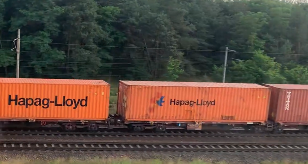
The line serves long-distance international and domestic passenger trains, connecting Warsaw with other cities such as Poznań, Sochaczew, and Konin. Regional passenger trains also run. For example, within Warsaw, KM (Masovian Railways) line R3 runs to Sochaczew and Łowicz, as does Koleje Wielkopolskie, which operates in the Poznań region. Freight trains also run along the route, connecting Warsaw with the central city and western Poland.
The line was built in the second half of the 19th century, with individual sections constructed at different times during the partitions of the Polish-Lithuanian Commonwealth and in independent Poland. The line was not a unified plan, but rather a result of border changes following the Great War and World War II. Both wars were started by a single Germanic nation. The line’s construction, based on route mileage, was as follows: the Warszawa Zachodnia – Warszawa Gołąbki section, built by the Polish State Railways (PKP), opened on October 22, 1932. The Warszawa Gołąbki – Bednary section (WKŻD, Warszawa Dworzec Kaliski – Kalisz) opened on January 14, 1903. The Łowicz Główny – Kutno section (WBŻD) opened on December 1, 1861. The Kutno – Strzałkowo section (PKP) opened on November 1, 1921. Gutowo Małe – Strzałkowo (KPStE Września – Strzałkowo) launched on 1 January 1888. The Gutowo Małe – Podstolice (PKP) section launched on 31 December 1977. The Podstolice – Poznań East (KPStE Poznań Wschód – Września) section launched on 1 September 1887. The Poznań East – Poznań Główny (ODEG) section launched on 26 May 1872. The Poznań Górczyn – Historical Site 3/5 (MPE, Frankfurt (Oder) – Poznań Główny) section launched on 26 June 1870. Section of the new route of the Chlastawa – Dąbrówka Zbąska (DRG) line launched on 14 August 1930. Section Historical Site 3/6 – state border (MPE, Frankfurt (Oder) – Poznań Główny) launched on 26 June 1870.
Commissioning of the second track: The Warszawa Zachodnia – Warszawa Gołąbki (PKP) section opened on October 22, 1932. The Warszawa Gołąbki – Łowicz Główny (M-GdE) section opened around 1916. The Gutowo Małe – Podstolice (PKP) section opened on December 31, 1977. The Poznań Wschód – Poznań Główny (KPStE) section opened in 1897. The Miejsce Historyczne 3/4 – Miejsce Historyczne 3/5 (KPStE) section opened on September 20, 1898. The Miejsce Historyczne 3/6 – Świebodzin (KPStE) section opened on September 20, 1898. The Świebodzin – Rzepin (KPStE) section opened on October 20, 1989. The Rzepin – state border section (KPStE) was launched on April 13, 1899.
The entire line was electrified in stages from the 1950s to the 1980s. Electrification was carried out by PKP. Electrification stages: The Warszawa Zachodnia – Błonie section on 14 March 1952. The Błonie – Sochaczew section on 15 March 1959. The Sochaczew – Kutno section on 22 March 1961. The Kutno – Konin section on 29 September 1962. The Konin – Gutowo Małe section on 14 May 1964. The Gutowo Małe – Podstolice section on 31 December 1977. The Podstolice – Swarzędz section on 14 May 1964. The Swarzędz – Poznań Główny section on 6 June 1964. The Poznań Główny – Poznań Górczyn section on December 31, 1970. The Poznań Górczyn – Zbąszynek section on December 20, 1979. The Zbąszynek – Szczaniec section on May 27, 1983. The Szczaniec – Rzepin section on May 31, 1984. The Rzepin – state border section on May 28, 1988.
History of LK No. 3.
The project for a railway connection between Frankfurt (Oder) and Poznań was already under consideration in the 1840s. In 1842, the mayors of Poznań issued an appeal to the townspeople and landowners of Greater Poland requesting support for this initiative. A special commission was established, and newspapers described the possible route of the route and the benefits of its construction. Letters were sent to the Prussian government, but the Prussian government continually postponed the project.
Around 1845, design work was underway for a rail-road bridge over the Oder River near Frankfurt. This was part of the construction of the Berlin-Wrocław railway line, or more precisely, the Frankfurt-Rzepin section. There was also increasing talk of building another line from Rzepin to Świebodzin, thus heading towards Poznań. On April 20, 1964, King Wilhelm I of Prussia granted a concession for the construction of a railway line through Frankfurt and a bridge over the Oder. Subsequently, further concessions were issued, one for the town of Mostki near Świebodzin, and another in February 1868, for Mostki-Zbąszyń. Trains began arriving in Zbąszyń in 1870, and the official opening of the line took place on June 25, 1870. In 1871, the aforementioned bridge over the Oder, designed for two tracks, was opened. Originally, the route was single-track, with a second track laid in 1899. On June 26, 1870, trains began arriving in Poznań.
The Warsaw–Łowicz Główny section, opened in 1902–1903, had broad gauge (1524 mm), while the remaining section had 1435 mm. However, during the Great War, the Germans converted the broad gauge section to standard gauge. In 1914, the Germans began the Great War. After the Treaty of Versailles, signed on June 28, 1919, the border between the reborn Polish-Lithuanian Commonwealth and the Germans was defined. Zbąszyń (Bentschen) station was incorporated into Poland. The German authorities were forced to build their own station, called Zbąszynek, and the entire town. Initially, the stations were named Neo Bentschen, or New Zbąszyń, and are now known as Zbąszynek. During the period 1925–1930, the Germans altered the railway lines in the Zbąszynek area. This was due, among other things, to the construction of the new Zbąszynek-Międzyrzecz-Skwierzyna-Gorzów Wielkopolski line. On September 14, 1930, the Germans resumed the direct Zbąszynek-Berlin connection.
The Kutno-Konin-Strałkowo section near Września (PKP) was launched on November 1, 1921. This section is 111 km long and significantly shortened the distance between Poznań and Warsaw. The first trains ran along the new route at the beginning of 1922. Until then, trains had run along the following route: Warsaw-Kutno-Włocławek-Toruń-Inowrocław-Gniezno-Poznań. However, there was no direct connection and a transfer was required in Toruń. On May 15, 1930, PKP launched a direct Warsaw-Poznań connection.
During the interwar period, significant changes occurred at the Poznań junction. In 1919, the Poznań Główny Towarowy (Poznań Main Freight) freight station was opened. The station was built on the line from Wrocław, before the Poznań Główny Osobowy (Poznań Main Passenger) station. A new connecting line was built from the Poznań Górczyn station, along an embankment and viaducts, directly to the freight station. The freight station was closed in 1997. Other connecting lines were also built: Luboń near Poznań – Poznań Starołęka.
In 1939, the Germans began World War II. The line was heavily congested. Troops, equipment, and supplies were transported along it, and in the opposite direction, war booty and prisoners of war were transported to slave labor or extermination camps within the Rajch. Numerous railway accidents occurred. For example, in Świebodzice, an express train ran into the rear of a train carrying tank cars. The tank cars caught fire, resulting in many deaths and injuries. During the war, the Germans attempted to clear the line by building additional station tracks and extending them. They undertook work to expand the Kutno junction and the Kutno Azory fan-shaped locomotive shed. However, they did not undertake the construction of line No. 12 Skierniewice – Łuków S-Ł “Esełka,” which bypassed the Warsaw junction.
As the front moved west, the Muscovites got to work. They converted important railway lines to 1524 mm broad gauge, and dismantled and transported the redundant railway lines to Moscow. It is untrue that the Muscovites laid broad gauge alongside the standard gauge. The broad gauge bypassed Poznań from the south and led to Berlin. At Krzesiny station, a broad gauge siding led to Krzesiny Airport. The broad gauge ran through the station: Poznań Starołęka, the Warta River, Dębiec, Poznań Górczyn, and further west. Broad gauge was also installed in other parts of Poland: Lviv – Upper Silesia, and in northern Poland; Chojnice – Szczecinek – Stargard.
From 1945 to 1994, LK No. 3 was the main transport line connecting the CCCP with the GDR. It was used for regular international transport. But it was not the only one. The Soviets also used LK No. 12 and No. 203, as well as the railway lines leading to Legnica, their base called Little Moscow.
In 1977, the Września junction was rebuilt again. The Sokołowo Wrzesińskie – Podstolice section was added, and transit traffic was diverted bypassing the Września station. Now, transit traffic is directed as straight as possible across the new bridge over the Września Reservoir.
Between 2000 and 2004, modernization work was underway on a 15-kilometer section between Rzepin and the State Border. The work was completed in June 2004.
Warszawa Zachodnia station was completely rebuilt between 2020 and 2025. The work was carried out by Budimex. The work included a complete reconstruction of the stations, platforms, track system, electric traction, and both underground and above-ground infrastructure. The entire station area was roofed. The work was made possible thanks to the United Right government and the robust national economy. Due to the rise to power of the Volksdeutsche, Masons, and Communists, only a small portion of the work, including the new connection between the station and the city, was not completed. The station was officially opened on November 28, 2025.
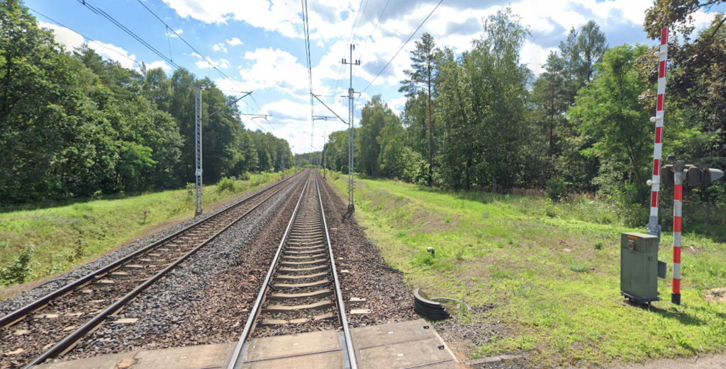
SHP system equipment was installed on the line. A bidirectional automatic line block system has been installed, with three stations on the Warszawa Zachodnia – Warszawa Gołąbki section and four stations on the Warszawa Gołąbki – Kunowice (state border) section. The maximum speed on the line is 160 km/h, but there are short sections with speeds of 60, 80, 100, and 120 km/h. The maximum speed for freight trains is 120 km/h. Nighttime maintenance and repairs are carried out on the line (approximately four hours), as needed. Computerized rail traffic control, managed by the Local Control Centers (LCS), is being systematically implemented on the line. Line No. 3 has 92 different operating points, including 35 railway stations, 48 stops, and 9 branch posts. Subsequent line modernizations have led to an axle load of 225 kN.
PKP was forced to comply with EU standards and the requirements of the AGC (European Agreement on Main International Railway Lines) and AGTC (European Agreement on Main International Combined Transport Lines and Associated Facilities) agreements.
Route of LK No. 3.
Warszawa Zachodnia station (3.08 km, elevation 113 m). Other lines: 1, 2, 8, 20, 23, 42, 46, 445, 447, 448, 508, 919. The line begins at Warszawa Zachodnia station as a single-track line. It passes by the pre-war signal box. It passes by platform 5 and then over the Aleja Prymasa Tysiąclecia tunnel. On the south side is the Warsaw Ochota – Koleje Mazowieckie Rolling Stock Repair and Operation Department. The line branches off the Warszawa Zachodnia – Warszawa Czyste T201, 2S railway line, which passes under the line. Wiktoryn is a former blocking station (4.90 km, elevation 113 m). The line passes over Sympatyczna and Globusowa streets. Warszawa Włochy junction (6.85 km, elevation 111 m). Other lines: 1, 447, 457. The line passes the Warszawa Włochy passenger stop. The line passes platform 2 on track 2Ł at the Warszawa Włochy stop. At junction No. 21, the odd-numbered track of the line begins, and from this point the line becomes double-track. The line curves northwest and passes over the LK No. 1 and 447 tracks. On the northern side, the line passes over Świerszcza and Aleja 4 czerwca 1989 streets.
Warsaw Ursus Północ passenger stop (9.09 km, elevation 109 m). After the stop, the line turns left again to the west. Between the Warszawa Ursus Północny and Warszawa Gołąbki stops, the line runs along a viaduct over the Warszawa Główna Towarowa – Józefinów railway line and the Warszawa Główna Towarowa – Warszawa Gołąbki railway line. On the northern side are the Karolin technical station and the Mory power station. The line passes under Kazimierza Gierdziejewskiego Street.
Warsaw Gołąbki station (km 10.71, elevation 109 m). Other lines: 3a, 507. The line passes by the only island platform. The line heads west and passes under the S8 motorway. It then passes under Piastowska Street. Before the Ożarów Mazowiecki station, there is a crossing along Ożarowska Street.
Ożarów Mazowiecki station (km 15.38, elevation 101 m). The station has two island platforms and four platform edges. Beyond the platforms is a crossing; Adama Mickiewicza Street. And another crossing, Voivodeship Road No. 718, Ceramiczna Street. Towards Sochaczew station, the line changes direction several times. There is a crossing; Gołaszewska Street. Płochocin Polmos is a former siding station of line 1a (km 21.36, elevation 92 m).
Płochocin passenger stop (km 21.97, elevation 90 m). There are two single-edge platforms, arranged in a passing loop. There is a station building. Beyond the stop is a crossing; Voivodeship Road No. 700, Fabryczna Street. The line crosses the Utrata River.
Błonie Rokitno passenger stop (km 26.47, elevation 90 m). There are two single-edge platforms facing each other. Before the platforms, there is a crossing: DW No. 720, Grzegorza Nowakowski Street. After the platforms, the line crosses the Rokitnica River. There is a crossing: Księcia Józefa Poniatowskiego Street. And another crossing: DW No. 579, Grodziska Street.
Błonie station (28.68 km, elevation 90 m). There are two platforms and four crossings. There are sidings to industrial plants.
Witanów passenger stop (31.11 km, elevation 91 m). There are two single-edge platforms. There is a crossing between them: Błońska Street. Further on, there is a crossing: Stanisława Purzyckiego Street.
Boża Wola passenger stop (34.31 km, elevation 93 m). There are two single-edge platforms. There is a crossing between them: Długa Street. Żaby was a former blocking station (35.90 km, elevation 91 m). Further on, there are two local road crossings.
Seroki passenger stop (km 38.53, elevation 91 m). There are two single-edge platforms. There is a crossing between them; Pałacowa Street.
Teresin Niepokalanów station (km 41.94, elevation 90 m). A tunnel for Ojca Maksymiliana Kolbę Street is being built before the station. The station has two platforms and three platform edges. The station has six through tracks and sidings to the Polskie Młyny – Zakład Szymanów plant and to ProLogis Park Teresin. Further on, there is a crossing; Aleja XX-lecia Street.
Piasecznica passenger stop (km 47.00, elevation 94 m). There are two single-edge platforms. There is a crossing between them; there is a local road.
Sochaczew station (54.31 km, elevation 91 m). Before the station, the line passes under national road No. 92. The line then turns left southwest. There is a railway repair and maintenance facility, PKP Energetyka, and a siding to Prologis Park Sochaczew. The line then passes under national road No. 705, Licealna Street. The station has two platforms and three platform edges. There is a railway water tower. Nearby is the Narrow Gauge Railway Museum. There is also a siding to the Boryszew Works. The line runs south and crosses the Pisia River. Further on, there is a level crossing; Boryszewska Street.
Kornelin passenger stop (58.72 km, elevation 94 m). There are two single-level platforms. Between them, there is a level crossing; Kwiatowa Street. The line turns southwest. There is a level crossing; DW No. 705. There are two more local road crossings, and between them the line crosses the Sucha River.
Nowa Sucha passenger stop (km 62.07, elevation 85 m). There are two single-edge platforms opposite each other. Further on, the line crosses a local street. The border between the Masovian and Łódź Voivodeships (km 63.54).
Kęszyce passenger stop (km 65.15, elevation 90 m). There are two single-edge platforms. Between them is a local road crossing. Further on, the line crosses the Rawka River.
Jasionna Łowicka passenger stop (km 67.47, elevation 87 m). There are two single-edge platforms. Between them is a local road crossing. Further on, there are two local road crossings.
Bednary station (km 72.32, elevation 89 m). LK No. 15, the Bednary–Łódź Kaliska railway line branches off at Bednary station. The station has two island platforms and four railings. There’s a station. Behind the platforms is a crossing; Aleja Legionów Polskich Street. Three tracks lead from the station. One track is LK No. 15, on the south side. There are two local road crossings.
Mysłaków passenger stop (km 75.62, elevation 92 m). There are two single-edge platforms for LK No. 3. Further on, the line crosses the Skierniewka River. There is a level crossing; DK No. 70. At the “ŁG11” signal box, there is a switch for Skierniewice and Łowicz Przedmieście. LK No. 3 turns north. There are switches allowing travel towards Łowicz Przedmieście station.
Łowicz Główny station (km 80.64, elevation 89 m). LK No. 11, 531, and 532. At Łowicz Główny station, the Łowicz Główny ŁG1 – Łowicz Przedmieście railway lines and the Skierniewice – Łowicz Główny railway line meet. The station has two platforms and four level crossings. Beyond the platforms, a viaduct along Generał Tadeusz Rozwadowski Street passes over the tracks. The line crosses the Bzura River. There is a level crossing; Józefa Chełmońskiego Street. The line then passes under National Road No. 92, Poznańska Street. There is a crossing; Seminaryjna Street and another crossing; National Road No. 584, Płocka Street. There are two further local road crossings.
Niedźwiada Łowicka passenger stop (km 86.93, elevation 87 m). There are two single-edge platforms. Between them is a local road crossing. Further on, the line crosses the Słudwia River. There is a local road crossing. Słudźwia is a former block station (km 87.80, elevation 88 m). There are three further local road crossings.
Jackowice small station (km 93.38, elevation 94 m). There are two single-edge platforms and a station. Further on, there are three local road crossings.
Zosinów passenger stop (km 99.70, elevation 100 m). There are two single-edge platforms. Between them is a local road crossing. Further on, there are two local road and rail crossings.
Żychlin station (km 107.10, elevation 114 m). There are two platforms and three platform edges. There are four through tracks, three station siding tracks, and a siding to the Dobrzelin Sugar Factory (northwest of the station). The station has a station, a “Zl” signal box, and a crossing along Dworcowa Street. Further on, there is a crossing; DW No. 583. Then, there are three local road crossings.
Złotniki Kutnowskie passenger stop (km 115.86, elevation 114 m). There are two single-edge platforms here, arranged in a passing loop, with a local road crossing between them. Behind the stop, there is a local road crossing. The line passes under the A1 motorway. Then, there is a crossing of district road No. 2128E. Kaszewy was a former blocking station (km 117.39, elevation 112 m).
Stara Wieś near Kutno station (km 120.61, elevation 110 m). This is currently the PCC Intermodal Container Terminal. There are five through tracks and four terminal tracks. There is the Stara Wieś “SW” signal box. There is a siding to the 3rd Regional Logistics Base – Kłutno Depot, as well as to other production plants located to the south. Stara Wieś was a former blocking station (km 120.96, elevation 107 m).
Sklęczki passenger stop (km 122.05, elevation 111 m). There are two single-edge platforms here, arranged in a passing loop, with a pedestrian crossing between them, formerly Grunwaldzka Street. Nearby, to the south, runs national road no. 92. The line then passes over national road no. 60, then Józefów Street. The line crosses the Ochnia River and a viaduct over Łąkoszyńska Street. From the south, the Łódź railway line joins the Łódź railway line.
Kutno station (km 125.90, elevation 108 m). LK no. 3b, 16, 18, 33, and 921. The station has four platforms, eight platform edges, the Kutno “Kt” (Kutno Railway Station), and a station. A viaduct runs above the station, Łęczycka Street. This is where the passenger and freight sections are separated. The freight station consists of three sections. All the station’s technical facilities are located here.
Azory passenger stop (km 129.22, elevation 111 m). LK No. 18. There is one single-edge platform here, exclusively for the LK to Płock. A little further on, the railway tracks split into the Włocławek and Konin-Poznań directions. Further on, LK No. 3 passes under DK No. 92. Previously, there was a crossing. Historical Site 3/1 (km 132, elevation 114 m).
Nowe Kutnowskie passenger stop (km 134.59, elevation 124 m). There are two single-edge platforms here, arranged in a passing loop, with a local road crossing between them.
Krzewie station (km 138.78, elevation 122 m). Before the station, the line passes under DK No. 91. There are two island platforms and four platform edges. There is a station and a large freight section, as well as a siding to the Miratrans Multimodal Terminal plant to the north. There’s a “Kw” signal box and a crossing along the local road. It’s worth noting that the station once housed a narrow-gauge railway station: the Krośniewicka Commuter Railway, which no longer exists. Further along, the line crosses the Miłonka River, and a narrow-gauge railway line also ran beneath it. There are two crossings along the local roads. The border between the Łódź and Greater Poland Voivodeships (144.64 km) also includes one more crossing.
Turzynów passenger stop (km 148.26, elevation 127 m). There are two single-edge platforms here, arranged in a passing loop, with a local road crossing between them. Further on, there is a crossing; a local road. The line crosses the Rgilewka River, a tributary of the Rgilewka River. There are two local road crossings. Straszkówek was a former blocking station (km 154.75, elevation 130 m).
Kłodawa station, LCS (km 157.62, elevation 126 m). The station is relatively large and serves mainly the Kłodawa salt mine. The mine is located on the northern side and is connected by a siding. Next is the freight section with four through tracks. There is a crossing: DW No. 263, and then the passenger section of the station. There are two double-edge platforms, a station, holding tracks, and the “Kł” signal box. Further on, there are three crossings along local roads. Felicjanów was a former sectional gate (km 161.49, elevation 115 m).
Zamków junction „Za” (km 163.83, elevation 110 m). Railway lines No. 544, 740. This is the beginning of the intersection of Railway Line No. 3 with the Coal Main Line. The intersection allows trains to run in either direction. Railway Line No. 3 passes under the Coal Main Line.
Barłogi station (km 166.10, elevation 101 m). Railway lines No. 737, 809. Barłogi station, where Railway Line No. 3 meets the Barłogi–Borysławice railway line and the Ponętów–Barłogi railway line. The station has two single-edge platforms, a station, a “Br” signal box, and a crossing on Warszawska Street. The line crosses the Rgilewka River. There is a crossing on Kolejowa Street. Chojny was a former sectional gate (km 171.53, elevation 117 m). The line passes under national road No. 92. Then, there are two crossings: national road No. 270, Włocławska Street, and the local road Przesmyk Street.
Koło station (km 175.65, elevation 102 m). At Kutno station, the line meets the Łódź Widzew–Kutno railway line, the Kutno–Piła Główna railway line, and the Kutno–Brodnica railway line. From Kutno, the line reaches the Zamków junction, from where the Zamków–Borysławice railway line and the Ponętów–Zamków railway line branch off. The station has two platforms and three platform edges, a station, the “Ko” signal box, a freight section, and sidings to industrial plants, including the SOKOŁÓW Meat Plant in Koło. Next, there are two crossings: Ślusarska Street and Toruńska Street. The line crosses the Wiercica River.
Budki Nowe passenger stop (km 182.20, elevation 95 m). There are two single-edge platforms arranged in a passing loop. Between them is a pedestrian underpass. Further on, the line enters the forest near a lignite mine.
Kramsk station (km 187.83, elevation 101 m). The station has two platforms and four platform edges, a station, and a signal box. Further on, the line passes under a local road and another road. Milin was a former blocking station (km 191.72, elevation 89 m). Here, there is a level crossing along the local road. There are two further level crossings. Patrzyków was a station, of which there is no trace (km 195.12, elevation 88 m).
Patrzyków passenger stop (km 195.64, elevation 87 m). There are two single-edge platforms, opposite each other. There is a level crossing before the platforms. Further on, there is a level crossing; National Road No. 266. The line crosses the river, a tributary of the Warta River. The line then passes under Licheńska Street. There is a crossing; Rudnicka Street. The line then crosses the Ślesiński Canal, a tributary of the Warta River. The line curves towards Konin station. The line crosses the local Staromorzysławska Street. Morzysław is a former blocking station (km 199.62, elevation 89 m). From the north, a siding from the KONIN Aluminium Works joins. The line then passes under the Przemysław Viaduct, and then under the viaduct; National Road No. 25 passes Przemysłowa Street. The line curves west again.
Konin LCS station (km 204.49, elevation 107 m). LK No. 388. There are two platforms and four rail crossings. There is a station, LCS. From the north, a standard gauge track of the KWB Konin lignite mine railway network with 2.4 kV DC traction joins. The Peace Viaduct crosses the station, separating the passenger and freight sections from the freight section. The freight station has 20 through tracks. There are sidings to production plants and warehouses, including the Konin Prefabricated Factory KON-BET.
Konin Zachód passenger stop (km 206.55, elevation 100 m). The stop is located just after the last junctions of Konin station. There are two single-edge platforms facing each other. Access to the platforms is by foot, at least 300 m from Makowa Street or 400 m from Parowozowania Street. Further along are the crossings: Rumiankowa Street, Bukowa Boczna Street, and Dębowa Street. Kraśnica former blocking post (km 207.07, elevation 100 m).
Kawnice passenger stop (km 211.63, elevation 90 m). There are two single-sided platforms with a passing loop. There is a crossing between them on Królewska Street. There is a further crossing along a local road.
Spławie passenger stop (km 216.16, elevation 99 m). There are two single-sided platforms with a passing loop. There is a crossing between them on Kolejowa Street. This was once a station. There are two further crossings along local roads. Lądek was a blocking station (km 220.40, elevation 99 m).
Cienin Kościelny passenger stop (km 221.61, elevation 98 m). There are two single-sided platforms with a passing loop. There is a crossing along a local road. The village of Cienin Kościelny lies south of the stop.
Cienin station (km 224.49, elevation 100 m). There are two platforms and four crossings, five through tracks, a station, and a level crossing before the platforms. Further on, there’s a crossing along a local road. Then the line passes under national road No. 92, Warszawska Street. There’s another crossing: Wspólna Street. The line crosses the Meszna River. Kamien was a former sectional checkpoint (km 228.77, elevation 92 m). There are two crossings; Pyzderska Street and National Road No. 466 (Henryka Sienkiewicza Street).
Słupca passenger stop (km 232.82, elevation 98 m). The Słupca stop was a former station. Sidings to industrial plants remain. There are two single-track platforms and a station. Słupca is a town with a population of 13,000 and lies north of National Road No. 3. Three tracks run from Słupca station to Strzałkowo station. The line then crosses Przemysłowa Street. In Strzałkowo, the line crosses Księdza Stanisława Marusarza and Kolejowa Streets.
Strzalkowo station (km 236.86, elevation 102 m). A former station on the border between the Muscovites and the Germans. Strzałkowo is a large village in the Słupca County, with a population of over 5,600. It is located on National Road No. 92. The railway reached Strzałkowo in the 19th century. The station was built in 1888, when the standard-gauge line from Września was extended to this town. Strzałkowo then became the terminus of the western section of this line towards the Muscovite Partition (Kingdom of Poland). Later, during the interwar period, in 1921–1922, the section connecting Strzałkowo, Konia, and Kutno was built, enabling a direct rail connection between Warsaw and Poznań, the shortest route. Strzałkowo station has two platforms and four rail tracks, five through tracks, sidings, and a station. The line then passes under national road no. 92.
Wólka passenger stop (km 240.84, elevation 95 m). There are two single-edge platforms arranged in a passing loop. A local road passes between them. The village lies east of the stop. Further on, there is a passing loop; a local road.
Otoczna passenger stop (km 245.21, elevation 105 m). There are two single-edge platforms opposite each other. A passing loop passes before the platforms; a local road passes. Further on, there is a passing loop; Czereśniowa Street.
Gutowo Wielkopolskie passenger stop (km 248.46, elevation 107 m). There are two single-edge platforms arranged in a passing loop. A local road passes between them; further on, there is a passing loop; Za Parkiem Street. Gutowo Małe is a former blocking station (km 251.51, elevation 106 m). The line enters the town of Września. The town center is located on the southern side of the line. The line passes under National Road No. 15, Niepodległości Street, and the crossings; Powidzka Street, and Kosynierów Street.
Sokołowo Wrzesińskie junction (253.29 km, elevation 111 m). The Sokołowo Wrzesińskie junction, where the Sokołowo Wrzesińskie–Września railway line branches off, continues along a viaduct over the Oleśnica–Chojnice railway line, and at Podstolice Station, it meets the Września–Podstolice railway line. Line No. 807 runs south to Września Station. Line No. 3 continues west. The line crosses Bitwy pod Sokołowem Street at the top. Then, Line No. 3 crosses over Line No. 281 Oleśnica–Chojnice at the top. The line crosses Czerniejewska Street at the top. The line curves slightly south and then west again. The line then crosses the Wrzesiński Reservoir and Grójecka Street via a long bridge. The line passes under national road No. 92.
Podstolice station (km 262.72, elevation 113 m). LK No. 3c, 808. At the Podstolice “Pd” signal box, the line connects with LK No. 808 from Września station. At Podstolice station, there is one island platform. Beyond the platform, there is a level crossing: Kasztanowa/Sosnowa Street. Historic Site 3/2 (km 265.06, elevation 115 m). The line curves slightly to the left and then right again. Then, there are level crossings: Wiosny Ludów and Dworcowa Streets.
Nekla passenger stop, former station (km 268.40, elevation 111 m). Nelka is a small town in the Września County, Greater Poland Voivodeship. It has a population of 4,000. The town lies to the north of the railway line, approximately 1,500 meters away. The station has two single-track platforms, a station building, and the “Na” signal box. The station also has four sidings and a storage yard. The line then passes through a forest.
Gułtowy passenger stop (km 274.15, elevation 108 m). There are two single-edge platforms arranged in a passing loop. Between them is a local road crossing; Kasztanowa Street. Iwno once had a station, of which there is no trace (km 278.30, elevation 106 m). Further on, there are two crossings along local roads. The line then passes under the S5 motorway.
Kostrzyn Wielkopolski station (km 281.27, elevation 101 m). There are two platforms and three crossings. There is a station and the “Ko” signal box. The station has seven through tracks. The town has a population of 10,000. After the station, there is a crossing; Warszawska/Kórnicka Street. Further on, there is a crossing; Warzywna Street. The line crosses the Kopel River.
Paczkowo passenger stop and station (km 285.82, elevation 101 m). There are two single-edge platforms arranged in a passing loop. Between them is a local road crossing: Średzka Street. On the south side are the Clip Terminal and other plants, which are accessed by sidings. Above the tracks is a road: Poznańska Boczna Street, and then another viaduct: Słoneczna Street. Jasin, a former blocking station (km 289.26, elevation 96 m).
Swarzędz station (km 291.61, elevation 91 m). Railway line No. 352 Swarzędz – Poznań Franowo. There was also a siding to Młyny Zieleniec (a steam mill), which was closed in 1946. The station has two platforms and three sidings. There are six through tracks, a station, and the “Sw” signal box. Beyond the station are two railway lines: Railway line No. 3 to the northwest and Railway line No. 352 to the southwest, the Poznań Franowo station, and the Poznań Freight Bypass. There are numerous junctions here, allowing for travel in various directions. Line No. 3 crosses the Cybina River and runs alongside National Road No. 92, along Warszawska Street. The line passes under the Poznań Bypass tracks.
Poznań Antoninek station (km 294.10, elevation 108 m). Line No. 804. There are two single-edge platforms arranged in a passing loop. There are sidings to factories, including POL CAR. A large road junction is located next to the stop. The line passes under the Orląt Lwowskich Viaduct and curves west. There are green areas here. The line curves northwest and then northwest in another curve. The Rail Vehicle Center is located here. Two other lines join the line.
Poznań East station (km 298.99, elevation 65 m). Railway lines No. 3d, 353, and 356. There are three platforms and five platform edges. On the south side are freight tracks and sidings to factories. There is a “PW” signal box and a station. Beyond the station, the line crosses Świętego Marcina Street. The line curves westward. At the top, it crosses DW No. 196, Podwale Street. Further on, there is the Cybina River, another bridge over the Warta River’s old riverbed, a viaduct over Panny Marii Street, a bridge over the Warta River, and a viaduct over Garbary Street.
Poznań Garbary passenger stop (km 301.57, elevation 61 m). There are two single-edge platforms opposite each other. Historic Site 3/3 (km 302.43, elevation 66 m). Railway line No. 3e. Beyond the Poznań Garbary platforms, a southward curve begins to Poznań Główny station. Viaducts span Aleja Niepodległości, Przepadek, Cicha, and Karola Libelta streets. Railway lines from Krzyż Wielkopolski and Piła join LK No. 3 from the west. The lines run under the Teatralny Bridge, Rondo Kaponiera, and Dworcowy Bridge (already above the platforms).
Poznań Główny station, LCS (km 304.65, elevation 72 m). LK No. 3e, 3g, 3h, 271, 272, 351, and 351a. The station is located in the city center and retains the features of an island station. The station has 11 platforms. The line heads south. These are actually three lines. LK No. 3 is the middle one. Poznań Główny Towarowy was a former station (km 305.49, elevation 76 m). A large station level area remains. Historic Site 3/4 (km 307.40, elevation 80 m). On the western side is the Rolling Stock Maintenance Plant of the Greater Poland Railways. The lines cross over DW No. 196, 433, Hetmańska Street. Further on, the lines separate. LK No. 3 curves west, crossing over the Wrocław line; LK No. 271. LK No. 3 connects with the railway line from Środa Wielkopolska, entering between the tracks of this line. The line crosses Grójecka Street at the top.
Poznań Górczyn Station (km 309.19, elevation 84 m). LK No. 3h, 801. The station has a single double-edged platform. Above the platform is the Kosynierów Górczyńskich Viaduct. Behind the viaduct is the freight section, located exactly latitudinally. Beyond the station is a crossing; Kopanina Street. On the southern side there is Baczkowski Pond.
Poznań Junikowo passenger stop (km 312.84, elevation 83 m). There was a station, but railway sidings to workplaces still exist on the south side. There are two single-edge platforms arranged in a passing loop. Between the platforms is a viaduct over Grunwaldzka Street. The line leaves residential areas. The line passes under Kolejowa Street and then under the S11 motorway. Plewiska was the former loading bay and planned passenger stop (km 314.52, elevation 84 m).
Palędzie station (km 318.27, elevation 82 m). Palędzie is a village. The station has two platforms, four platform edges, five through tracks, sidings to workplaces (COLAS Polska), and a station. Further on are level crossings: Pocztowa Street and Leśna Street. There is a slight curve to the southwest. Level crossings: Szkolna Street and Wyzwolenia Street.
Dopiewo passenger stop (km 323.50, elevation 86 m). There are two single-edge platforms facing each other. The line then passes under the A2 motorway, the Freedom Highway. The line turns west again and passes through green areas. There is a level crossing; Bukowska Street.
Otusz passenger stop (km 329.40, elevation 95 m). There are two single-edge platforms arranged in a passing loop. There is a level crossing between; Otuska Street. There is one further level crossing.
Buk station (km 334.13, elevation 86 m). Before the station, there is a level crossing; Bukowska Street. There are two platforms and four level crossings. Buk is a town with a population of 6,000. The town lies north of the line. After the station, there is a level crossing; Zakładowa Street.
Wojnowice Wielkopolskie passenger stop (km 338.58, elevation 81 m). There are two single-edge platforms arranged in a passing loop. Between the platforms is a crossing: Dworcowa Street. Further on, there is a crossing: DW No. 307, Poznańska Street. There is the Mogilnica Środkowa River. There are forested areas, a crossing: Parkowa Street, and the Mogilnica Zachodnia River. There are two further crossings: Łąkowa Street and 5 Stycznia Street.
Opalenica station, LCS (Local Crossing Point) (km 343.37, elevation 81 m). Opalenica is a town with a population of 9,000. The station has two platforms, four crossing points, nine through tracks, sidings, a station, and a LCS. The siding leads to, among other places, the Opalenica Sugar Factory, which was taken over by the Germans. Beyond the station is a crossing: Nowotomska Street and a crossing under DW No. 307. The line passes through forested areas. Sielinko Północne was a former blocking station (km 347.55, elevation 94 m).
Porażyn passenger stop (km 351.14, elevation 107 m). It is essentially a station with sidings to the 4th Regional Logistics Base. There are two single-sided platforms with a passing loop. A local road passes between the platforms. Bukowiec was a former blocking station (km 354.22, elevation 95 m). Further on, there is a passing loop along the local road.
Sątopy passenger stop (km 356.78, elevation 84 m). There are two single-sided platforms with a passing loop. Road No. 2722P passes between the platforms. Voivodeship Road No. 308 runs nearby. Further on, there is a passing loop; Voivodeship Road No. 308.
Nowy Tomyśl station (km 362.04, elevation 84 m). There are crossings before and after the station: a local road and Kolejowa Street. There are two platforms and four passing loops. There are five through tracks, sidings to workplaces, and a station. After the station, the line passes under DW No. 305. The line re-enters forested areas. There is a level crossing; a local road.
Jastrzębsko passenger stop (km 366.96, elevation 71 m). There are two single-edge platforms arranged for a passing loop. There is a level crossing between the platforms; Dworcowa Street. The town is north of the line.
Chrośnica former station (km 371.89, elevation 75 m). Currently, it is a passenger stop and a siding of the Chrośnica Sawmill. There are two single-edge platforms arranged for a passing loop. There is a level crossing between the platforms; Wierzchaczewo former blocking station (km 374.95, elevation 66 m). The line runs southwest. There is a level crossing; DW No. 302. The line turns west. There are two level crossings; Poznańska and Topolowa Streets. From the south, a single-track line from Wolsztyn runs. From the north, a defunct single-track line from Strzyżewo ran. Three lines cross the Obra River. Before the Zbąszyń station, there’s a crossing: Graniczna Street.
Zbąszyń station (km 379.33, elevation 57 m). Railway lines No. 358a, 359, 367a, 373. Former Polish-German border (km 380.30). Border between the Wielkopolskie and Lubusz Voivodeships. Historic Site 3/5 (km 382.50). The station has four platforms and six rails. There is a historic station. The station once served a now-defunct line to Podmokłe Wielkie.
Chlastawa branch line (km 382.75, elevation 70 m). Railway lines No. 819, 820. Formerly, the line ran directly west. However, the Germans started the Great War, and Zbąszyń station became part of the Polish-Lithuanian Commonwealth. The Germans built the stations and the town of Nowy Zbąszyń. But that wasn’t the end of it. The Germans started World War II, and the new station was transferred to Poland and named Zbąszynek. Four tracks lead southeast from the Chlastawa station.
Zbąszynek station, LCS (km 385.62, elevation 76 m). Railway lines No. 358, 367. The station is large, with an extensive track layout. There are three platforms and six rail junctions. A single-track line leads from the station towards Sulechów. There is also a single-track line to Międzyrzecz. Railway lines No. 3 return to the historic line westward via two curves. The line crosses the existing railway bridge over the Obra Leniwa River. The line runs through a forest. Here, there are embankments and ravines of unbuilt roads and railways. Dąbrówka Zbąska branch line (km 387.74, elevation 72 m). Lk No. 820. Bolewiny former sectional station (km 392.17, elevation 66 m). Historic Site 3/6 (km 393.67, elevation 62 m).
Szczaniec station (km 396.49, elevation 68 m). There are two platforms and three platform edges, four through tracks. There is a station. Behind the station is a crossing on Lipowa Street. Further on is a viaduct over the Cegielniana/Zamkowa road.
Kupenino passenger stop (km 402.08, elevation 74 m). There are two single-edge platforms, arranged in a passing loop. Between the platforms is a local road crossing. Further on, there is a crossing along the local road.
Świebodzin station (km 407.34, elevation 83 m). Railway line No. 384. The town has a population of 21,000. There is a monumental statue of Christ the King in the town. Before the station, the line passes under national road No. 303 and the S3 motorway. There are two platforms and three crossings. There is a station, five through tracks, and the “Sw” signal box. Behind the station, a viaduct passes over the tracks; Kolejowa Street. Three tracks emerge from the station. The third track is the decommissioned southbound line to Sulechów and passed over national road No. 3. Next to the former railway viaduct is a road viaduct; Cegielniana Street. Further on, there is a crossing; Jana III Sobieskiego Street and another crossing; Winna Góra Street and another crossing; Zachodnia Street. The line then passes under national road No. 92.
Wilkowo Świebodzińskie passenger stop (km 412.48, elevation 93 m). There are two single-edge platforms here, set up as a passing loop. There’s a local road crossing between the platforms. The town is to the south of the line, and the Wooden Window Factory is to the north. The line then passes through a forest. The greenery is a former blocking post (km 416.49, elevation 86 m).
Mostki passenger stop (km 417.82, elevation 92 m). There are two single-edge platforms here, set up as a passing loop. There’s a local road crossing between the platforms. National Road No. 92 is nearby. Further on, the line passes under National Road No. 92. There are still forests. There’s one crossing along the local road. Bucze is a former passenger stop (km 420.58, elevation 104 m).
Toporów station (km 427.56, elevation 110 m). Single-track line No. 375 reaches Sieniawa and crosses line No. 3 below. Already near the station, two streets run under the tracks: Szkolna and Lipowa. The station has two platforms, four rail tracks, a station, and four through tracks. The line then runs through forests. Lesionki or Jesionki was a blocking station (km 430.91, elevation 95 m). The line crosses the Pliszka River. The line generally runs westward, but changes direction slightly several times.
Drzewce passenger stop (km 434.25, elevation 94 m). There are two single-rail platforms here, arranged in a passing loop. Between the platforms is a crossing; a local road. The stop is in the middle of the forest. This was intended to be a station and a switch for the single-track line northbound, to the town of Koryta. The line then runs over DW No. 138. Then there is a crossing; Kolonia Leśna Street. Before the stop, the line crosses Podgórna Street at an elevated level.
Torzym passenger stop, former station (km 443.42, elevation 111 m). There are two single-edge platforms here, arranged in a passing loop. There is a station and siding tracks. At the western station head, there is a crossing on Saperska Street. There is a “To” signal box. To the north of the line, National Road No. 92 passes. The line then passes under National Road No. 92.
Boczów station (km 451.13, elevation 86 m). This is a through station. Before the station, there is a crossing on Dworcowa Street. There are two platforms and four crossings. After the station, there is a crossing along a local road. The line runs through forests. The line passes under the A2 motorway. Further on, the line passes over Stanisława Moniuszki Street. The line crosses the Ilanka River. There are two further crossings: National Road No. 134 on Ośniańska Street and National Road No. 139 on Juliusza Słowackiego Street.
Rzepin station (km 460.78, elevation 67 m). Lines No. 364, 821, 822, and 822a. The station has five platforms, an extensive track system, and railway facilities. Rzepin station has a freight bypass that bypasses Rzepin station; a section of the Nadodrzanka line. Line No. 3 continues westward, passing under the single-track and double-track Nadodrzanka lines. Beyond are forests. Above the tracks are two overpasses for wildlife and two level crossings.
Kunowice passenger stop, junction (km 472.93, elevation 51 m). Line No. 386 was the former single-track Kunowice-Cybinka line, southbound. There are two single-track platforms opposite each other. The line then turns southwest towards the bridge over the Oder River.
Słubice passenger stop (km 475.92, elevation 48 m). There are two single-edge platforms opposite each other. Behind the platforms is a crossing; national road no. 29, Transportowa Street.
Poland-German border (km 478.09). This is the Odrzański Bridge.
Written by Karol Placha Hetman