Poznań 2026-04-13
Railway line No. 272 Kluczbork – Poznań Główny.
Railway line No. 272 Kluczbork – Poznań Główny runs northwest, is 201.868 km long, is double-track, and electrified at 3 kV DC. The maximum speed is 120 km/h. The line lies within the Opole and Greater Poland Voivodeships.
The history of the Kluczbork – Poznań railway line began in 1875. On October 1, 1875, the Poznań-Kluczbork Railway Company opened its line: Poznań – Środa Wielkopolska – Jarocin – Kluczbork. On October 7, 1872, a concession was issued to the Poznań-Kluczbork Railway Company, with its headquarters in Poznań, for the construction of the Kluczbork-Poznań railway. Designs for the route had been in development since 1867.
Construction began, but poor financing caused work to be interrupted. Corruption was rampant, and workers were not paid on time and frequently abandoned the construction site. The situation improved with contributions from defeated France. Construction was not completed until December 1875. On December 10, 1875, the first train ran between Poznań and Kluczbork. Not all of the engineering structures were completed. Initially, three pairs of trains ran on the Poznań-Kluczbork route: two passenger trains and one freight train. In reality, passenger trains were composed of freight cars. There were four classes of passenger cars. A passenger train’s stop at the Środa Wielkopolska station lasted five minutes. The train covered the Jarocin–Poznań route in 1 hour and 55 minutes, covering a distance of 70 km.
The development of the railway contributed to economic recovery. The railway facilitated the transport of goods, primarily agricultural products, and increased the city’s importance in the region. Railway infrastructure was built: a station, sidings, warehouses, a storage yard, and technical facilities.
The process of nationalizing the railways in the German state did not take place in a single year, but in stages. The most crucial period was 1879–1884. This was when the Prussian state purchased most of the private railway lines. This was beneficial for passengers, as they purchased tickets from the starting station to the destination. In 1879, a law was passed nationalizing the previously private railway lines. Thus, in 1884, the state authorities purchased the Poznań-Kluczbork railway. Following the nationalization of the railways, administrative reorganization took place, establishing offices for traffic, tariffs, rolling stock, routes, and workshops. Individual offices sent reports to the management, based on which orders were issued and tasks financed. Subsequent railway lines were built with state funds.
The launch of the second track took place in stages. In 1896, the second track was opened on the Kluczbork-Łęka Opatowska section (KPStE). In 1891, a second track was opened on the Łęka Opatowska – Ostrów Wielkopolski (KPStE) section. In 1897, on the Ostrów Wielkopolski – Jarocin (KPStE) section. In 1911, on the Jarocin – Poznań Główny (KPStE) section.
Electrification of LK No. 272; on September 7, 1973, on the Kluczbork – Ostrów Wielkopolski (PKP) section. On September 30, 1974, on the Ostrów Wielkopolski – Jarocin (PKP) section. On December 31, 1974, on the Jarocin – Poznań Starołęka (PKP) section.
After World War II, the entire Kluczbork–Poznań Główny line became part of the Polish-Lithuanian Commonwealth. Until 1989, the line was systematically maintained. However, after 1989, when communism supposedly fell in Poland, financial support for maintenance was significantly reduced. The entire route contained wooden sleepers, which were slowly deteriorating. There were no plans to revitalize the line, even within the next 10 years. There were no plans to repair the railway stations and platforms. Many level crossings require urgent modernization. These crossings are the reason why the line speed is limited to 120 km/h. Warsaw ignored the fact that Line 272 is one of the 7,500 km of railway lines in Poland that generate the highest revenue. However, the funds available for repairs and maintenance at the time were insufficient.
After several years, it was decided that the necessary work on the Ostrów Wielkopolski–Poznań section would be completed first. The goal was to restore passenger train speeds to 120 km/h. The Kluczbork – Ostrów Wielkopolski section was placed on the reserve list.
On July 19, 2010, at the Poznań Branch of the PKP PLK S.A. Investment Implementation Center, a contract was signed for the project “Resurfacing and associated works at Mieszków station and adjacent tracks on track No. 1 of railway line No. 272 Kluczbork – Poznań Główny, over a distance of 12.1 km, covering a section of 133.918 km – 146.015 km.” The contract was awarded to the “Konsorcjum Poznań” (Poznań Consortium), consisting of four smaller companies. The work was completed in 2010-2011. The investment cost was PLN 23,846,120. In subsequent years, the section was modernized; 131,500 km – 133,918 km and 150,160 km – 166,653 km. Tracks were replaced along a distance of 18,900 km. Ten turnouts were replaced and 14 level crossings were repaired. Twenty-four engineering structures and drainage systems were repaired. Railway traffic control equipment was improved.
In subsequent years (2011-2014), only one level crossing was repaired. Between 2015 and 2022, further repairs were carried out, but not comprehensively. 19,000 km of track and 40 turnouts were replaced, platforms at major stations were repaired, 19 level crossings, and 30 engineering structures, primarily culverts, were repaired. Current plans call for the route, in the Poznań area, to be repaired after 2027. The chance to renovate the route is only after 2030. Unless the December 13 government falls before then; the Volksdeutsche, post-communists, and Freemasons.
LK No. 272 includes 27 bridges, 44 viaducts, 111 level crossings, and one footbridge. The most challenging terrain for the builders was the area around Ostrzeszów. Ostrzeszów lies in the southern part of the Greater Poland Voivodeship, on the border of several mesoregions. The terrain is slightly undulating, with distinct but not very high elevations, reaching elevations of up to 200-280 meters. These are the Ostrzeszów Hills, some of the higher elevations in Greater Poland. Smaller rivers and streams, such as tributaries of the Prosna River, flow through the area. Therefore, LK No. 272 traverses these terrains using eight curves and several ascents and descents. The highest point of the railway line has an elevation of 210 m. Ostrzeszów station lies at an elevation of 206 m.
LK No. 272.
Kluczbork station (0.00 km, elevation 183 m). LK Nos. 143, 143b, 175, and 293. The Młynówka River flows under the tracks. Above the tracks is a viaduct; Wólczańska Street, from which the access to the island station runs. The tracks split, with the line to Oleśnica to the west and the line to Kępno station (LK No. 272) to the north. There is a freight station on the western side. The line passes under Miarki Street. The line then passes under national roads No. 42 and 45 (Kluszbork Bypass). The line leaves Kluczbork.
Gotartów was a branch line (2.81 km, elevation 185 m). National Road No. 768. This was a bypass line that bypassed Kluczbork station. National Road No. 272 traverses agricultural land. There are two local road crossings. There is a crossing; National Road No. 11. There is the Baryczka River. There is one local road crossing.
The curve was a station, now a stop (6.33 km, elevation 188 m). There are two single-edge platforms and former station buildings. There are switches that can redirect trains to a third track, from the east. Behind the platforms is a crossing; Witosa Street. The line crosses one local road. There is the Pratwa River.
Biskupice near Kloczbork passenger stop (km 11.42, elevation 195 m). There are two single-track platforms and the station building is preserved. Behind the platforms is a local road crossing. There are two local road crossings. There is also a crossing on National Road No. 11.
Byczyna Kluczborska station (km 16.12, elevation 194 m). Before the station, the line passes under Polanowicka Street. Currently, the station has four through tracks and two single-track platforms. There is a two-story station building, which is occupied by residents. There are warehouses, a storage yard, and a ramp. Behind the station, the line passes under Moniuszki Street. Further under the line, a local dirt road passes under the line. The line passes under a local road.
Gołkowice former passenger stop (km 19.33, elevation 176 m). There are three local road crossings and a crossing on Leśna Street. There is also the Pratwa River.
Kostów station (km 23.25, elevation 170 m). A local road crossing is located in front of the station. The station has one island platform, a station, and three through tracks. The Opole/Greater Poland Voivodeship border is at km 24.35. The line passes under Kościelna Street. There are two local road crossings. Raków was a block station (km 27.10, elevation 172 m). There is a crossing; Rakowska Street. There is the Pomianka River.
Łęka Opatowska station (km 30.29, elevation 171 m). There is a crossing; Lipowa Street. The station has five through tracks, two platforms, three platform edges, a station, and warehouses. There is a local road crossing. There is a crossing; National Road No. 11. There are crossings; Radosna Street and Szeroka Street.
Słupia passenger stop (km 35.57, elevation 171 m). There are two new single-edge platforms, with a crossing between them; Dworcowa Street. The station buildings have been preserved. The line crosses the Jamica and Niesób rivers. The line then passes under the S11 motorway. Baranów was the former blocking station (km 38.79, elevation 170 m). Then there’s a crossing; Budka Street. The line crosses Jasna, Wieluńska, and DW No. 482 streets at the top.
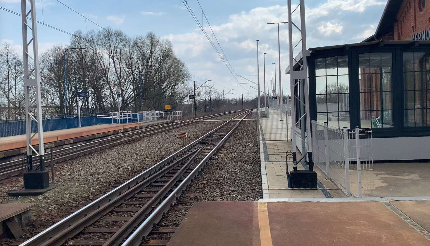
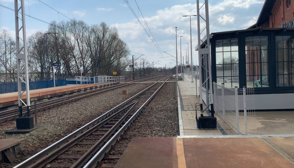
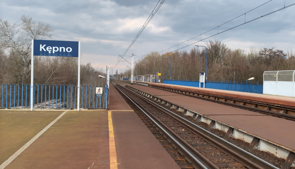
Kępno station (km 40.91, elevation 180 m). Line No. 181, 307, 812, and 814. The line crosses Dworcowa Street and the lower tracks at Kępno station at the top. Line No. 272 has two single-edge platforms. Further on, connecting tracks from the west and east, as well as sidings from industrial plants, reach Line No. 272. There is a crossing; Grabowska Street.
Hanulin freight station (km 42.93, elevation 173 m). Line No. 812, 813, and 814. There is a water tower at the station. Another connecting track from the lower Kępno station, at the Hanuli “Hu” signal box, leads to the western side. There is a crossing of the plant road. There is also the PKP Energetyka plant. The line then passes under the S8 motorway “Route of the Heroes of the Battle of Warsaw 1920.” There’s a local road crossing. The line passes under the S11 highway. The line enters the forest.
Domanin station (km 47.12, elevation 185 m). There are three through tracks, two platforms, a station, and a local road crossing. The line then follows several curves. Rogaszyce was a branch line (km 51.22, elevation 193 m). The line passes over Królewska Street, which was previously LK No. 383 Ostrzeszów – Namysłaków. Ostragóra was a sectional line (km 54.93, elevation 210 m). There’s the Zalesianka River. There are two forest road crossings. Further on, the line passes three times over forest roads. There’s a crossing: Zielone Wzgórza housing estate street. There’s a crossing: Mikorska Street. The line passes under Lazurowa and Świętego Mikołaja streets. Then, it passes over Młyńska Street.
Ostrzeszów station (km 58.10, elevation 206 m). Railway line No. 383. There is a level crossing before the station; DW No. 449 (Grabowska/Kolejowa). There is an island platform, a water tower, a station, a passenger tunnel, and nine through tracks. At the northern end of the station, there is a level crossing; Powstańców Wielkopolskich Street. Further on, there are level crossings; Gruszowa, Jeżynowa, and Czereśniowa Streets. Further on, there are two forest road crossings. Marydoły was a blocking station (km 63.05, elevation 177 m).
Niedźwiedź Wielkopolski passenger stop (km 67.02, elevation 150 m). There are two single-edge platforms, separated by a road crossing.
Antonin station (km 70.56, elevation 138 m). There is an island platform, three through tracks, and a station. There is a level crossing after the station. National Road No. 447. The line continues through forests. Further on, the line passes under National Road No. 11 and 25 (Wrocławska Street). Kocięba is a former sectional gate (74.42 km, elevation 132 m).
Przygodzice station (77.30 km, elevation 129 m). Before the station, there’s a forest road. There are three through tracks, an island platform, and a station. The line leaves forested areas and enters agricultural land. The line crosses the Bartsch River. The line crosses Szkolna and Gospodarcza streets at the top. The line passes under Mostowa Street.
Janków Przygodzki passenger stop (km 81.82, elevation 147 m). There are two single-track platforms. Behind the platforms is a crossing: Sosnowa Street. The line passes under Osiedlowa Street and then over Brzozowa Street. On the eastern side, there is an old gauge line, the tracks of the Polish Tabor Szynowy plant, and siding tracks. The tracks pass under the “Zębcowski” Bridge. From the western side, two railway lines join: Odolanów (single-track) and Krotoszyn (double-track).
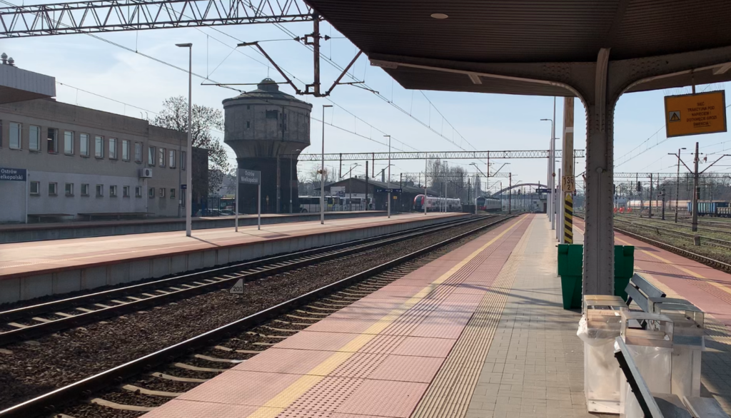
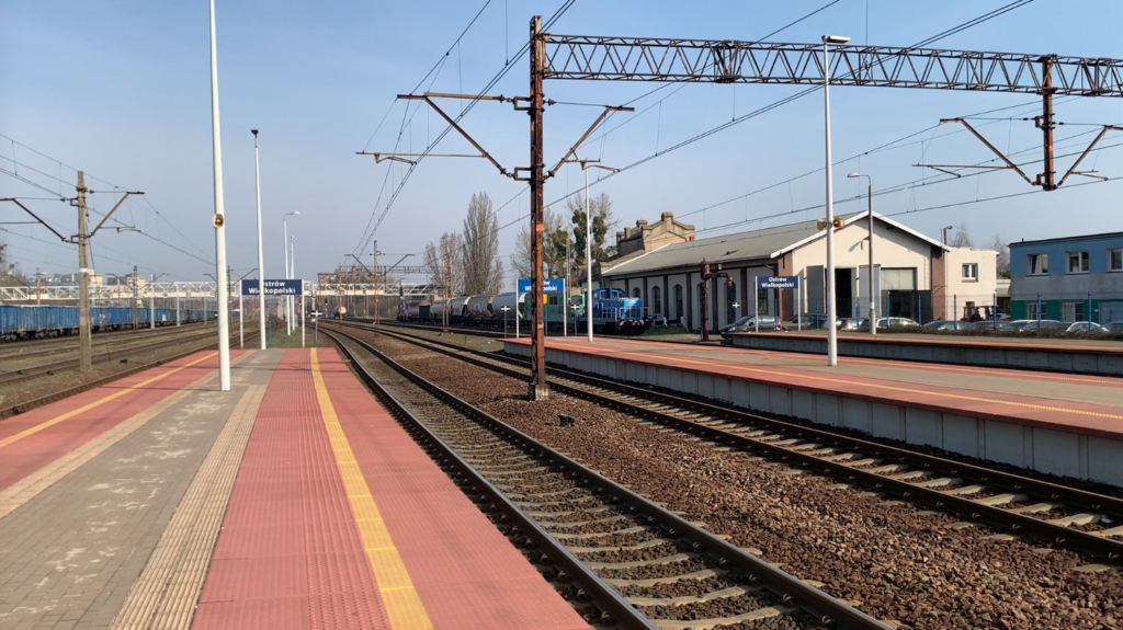
Ostrów Wielkopolski station (km 86.25, elevation 135 m). Lines No. 14, 14b, 14c, and 355. The tracks pass under the “Odolanów” Bridge. There are three platforms, numerous freight tracks, two fan-shaped locomotive sheds, a passenger tunnel, a footbridge, and sidings. Further on, the tracks pass over Krotoszyńska Street. The tracks split into LK No. 272 and the lines to Kalisz. Both lines cross the Ołobok River and a local road. The lines intersect; at the bottom, the line runs to Kalisz. There is a crossing; DK No. 36 (Poznańska Street).
Franklinów “Fk” junction (90.34 km, elevation 140 m). From the east, LK No. 811 joins from the Kalisz direction. Lewków (Lewkowiec) is a former passenger stop (92.80 km, elevation 150 m). There are six local road crossings.
Biniew station (96.39 km, elevation 152 m). There are four through tracks, two tracks, a station, and a “Bi” signal box. Górzno is a former block crossing (99.26 km, elevation 155 m). There are four local road crossings.
Bronów station (km 102.77, elevation 152 m). There are four through tracks, two single-track platforms, a station, and a local road crossing. Further on, there are two local road crossings. There is the Sowinka River.
Taczanów passenger stop (km 107.81, elevation 151 m). This was formerly a station. It is possible for a moving train to change tracks. There are two single-track platforms, a station, and a local road crossing. Further on, there are three local road crossings. Baranówek was a blocking post (km 110.94, elevation 148 m).
Pleszew station (km 114.04, elevation 139 m). Line No. 392. Before the station, the line turns west. There is a station, five through tracks, two platforms, railway line No. 392 to the center of Pleszew, a station, the “Pl” signal box, and the Pleszew Local Railway. There are four road crossings. Suchorzew is a block control point (km 117.03, elevation 129 m).
Kotlin station (km 120.38, elevation 129 m). There are three through tracks, two platforms, a station, and the “Kt” signal box. Next is a crossing: Tadeusza Kościuszki Street and two more crossings. The line crosses the Lutynia River. There are two more road crossings.
Witaszyce station (km 126.99, elevation 133 m). Line No. 7046. There are two single-track platforms, four through tracks, a station, the “Ws” signal box, and a level crossing; Kolejowa Street. Further on, there is one road level crossing. The town of Jarocin. The line crosses over National Road No. 15 (Wrocławska Street). The line crosses over the single-track Oleśnica-Gniezno line (LK No. 281).
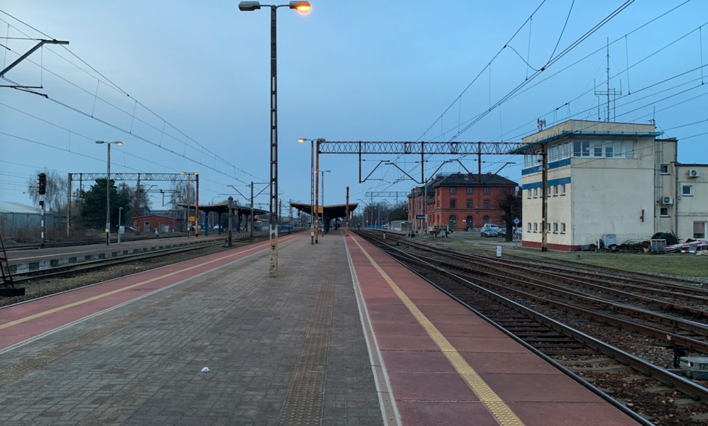
Jarocin station (133.57 km, elevation 125 m). Line No. 281, 360. Before the station, the line crosses under National Road No. 12, Powstańców Wielkopolskich Street. Jarocin is a large junction station. There are four platforms, six platform edges, an island station, a water tower, a former locomotive shed, and a large freight station. Beyond the station, the tracks cross over Niepodległości Avenue. Line No. 272 heads northwest and enters the forest. The line crosses over forest roads twice; Łąkowa Street and Leśna Street. The line crosses the Lubionka River. The line passes under a local road. The line crosses the Lubieszka River (Obra Canal). There are level crossings: Osiecka Street, Dworcowa Street.
Mieszków station (km 140.97, elevation 103 m). Railway line No. 369 Mieszków – Śrem; it was single-track, non-electrified. There are two platforms, four through tracks, a station, and a “Mk” signal box. Further on, there are three local road crossings. The line crosses the Roguski Canal. There is a level crossing: DW No. 436, Śremska Street.
Chocicza station (km 149.31, elevation 82 m). There are two platforms, three through tracks, a station, and the “Ch” switch. Further on, the line passes through forests and fields. There are three crossings over dirt roads. The line crosses the Warta River on the longest bridge on the line. Opened in September 1875, it is 338 m long, has 10 truss spans for each track, two abutments, and 9 brick-and-concrete piers. The last renovation was carried out in 2020.
Solec Wielkopolski passenger stop (km 154.21, elevation 68 m). Before the stop, there is a road crossing. There are two single-edge platforms separated by a road crossing; Kolejowa/Główna Street. There is a small station. Further on, there is a truss bridge over a small lake. There is a crossing; Wiatraczna Street and another crossing of a forest road (Wiatraczna Street) and another crossing; Mostowa Street. The line crosses the Borowski Canal. There is a level crossing; Główna Street.
Sulęcinek station (157.56 km, elevation 70 m). There are three through tracks, two platforms, a station, and the “Su” signal box. Next, there is a level crossing; Słoneczna/Lipowa Street. There is a truss bridge over the Szywra River. Then there are level crossings; Sosnowa Street, Klonowa Street. There is a bridge over the Moskawa River. The line crosses a local road. There are level crossings; Kwiatowa Street, Podmiejska Street. The line passes under national road No. 11. There is a level crossing; national road No. 432.
Środa Wielkopolska station (167.03 km, elevation 78 m). LK No. 7001; Środa County Railway. There are two platforms, three platform edges, a station, four through tracks, and the “Sd” signal box. Beyond the station, the narrow-gauge railway passes over LK No. 272. There is a level crossing; Kórnicka Street. Further on, the line crosses two local roads.
Pierzchno passenger stop (km 176.47, elevation 82 m). There are two single-edge platforms and a station. Further on, the line crosses three local roads.
Kórnik passenger stop (km 181.07, elevation 82 m). There are two single-edge platforms. Before the platforms, there is a level crossing; DW No. 434, Dworcowa Street. Further on, there are two local road level crossings.
Gądki station (km 185.34, elevation 77 m). There are six through tracks, one island platform, a station, industrial sidings, and the “Gd” switchgear. The S11 motorway passes over the tracks. Further on, there is a level crossing; Telewizyjna Street. There is the Kopała River. There are level crossings; Drukarska Street, Dziennikarska Street, Krzesiny Street.
Poznań Krzesiny station (km 191.62, elevation 80 m). Line No. 394 to Krzesiny Airport. There are six through tracks, an island platform, and a “PKr” signal box. The A2, S5, and S11 motorways pass above the tracks. The single-track Poznań Freight Bypass branches off line No. 272 northward. The double-track Poznań Freight Bypass (Starołęka – Miników – Marlewo) joins the line from the north. The tracks pass under Gołężycka Street. Poznań Starołęka station (km 194.61, elevation 76 m). Line No. 272a, 352.
Poznań Starołęka station (km 196.00, elevation 65 m). Line No. 272b, 352. There is an island platform and a station. Beyond the platforms is a crossing; Starołęcka Street. Poznań Starołęka PSk2 station (km 197.17, elevation 70 m). Railway lines No. 801, 802. Warta River and a bridge with two tracks; Dębiński Bridge. The line passes over DW No. 430, Dolna Wilda Street.
Poznań Dębina passenger stop (km 197.64, elevation 65 m). Two single-edge platforms. The line turns north. The line passes under 28 Czerwca 1956 Street. The line then passes over DW No. 196, 433, Hetmańska Street. Three railway lines run alongside each other here. The tracks pass the Wielkopolska Railway Base and the former freight station.
Poznań Main Station (km 200.90, elevation 72 m).
Written by Karol Placha Hetman