Głogów 2025-05-15
Railway line No. 14 Łódź Kaliska – Tuplice.

Railway line No. 14 Łódź Kaliska – Tuplice runs latitudinally, from east to west. The line is 388.578 km long, partly double-track, partly electrified with 3 kV DC current. The maximum speed is 120 km/h. The line historically consists of several sections built in different periods, by different companies, in different track gauges and for other reasons. Currently, the tracks are 1,435 mm wide. Individual sections were built in the period 1846-1915. Electrification took place in the period 1965-1981. Currently (2025) only some sections are important for the national economy. The railway line is equipped with the SHP system along its entire length. Line No. 14 belongs to freight corridor No. 8.
Freight Corridor No. 8.
Rail freight corridors are a European undertaking aimed at increasing the attractiveness of rail transport compared to other modes of transport. The obligation to implement them was imposed on Poland by Regulation (EU) No. 913/2010 of the European Parliament and of the Council of 22 September 2010 on a European rail network for competitive freight transport. In reality, this is the imposition of the European Union agenda on the Member States according to Berlin’s will. Even a 500 km long route running through two countries can be subordinated to Berlin’s decisions. Corridors No. 5, 8 and 11 were imposed on Polish railways. RFC Corridor No. 8 – North Sea – Baltic Sea; leading from Belgium and the Netherlands through Germany, Poland, Lithuania, Latvia to Tallinn in Estonia. The corridor was created on 1 January 2013. In this case, an analogy to the situation before World War II comes to mind; Another point depriving Poland of sovereignty. EU funds go to beneficiaries for specific investments designated by Berlin. Among them is the project of corridor No. 8.
CPK Program.
Let us remember that during the United Right Government (2015-2023), the Central Communication Port (CPK) program was created. A system of so-called Rail Spokes was developed so that 90% of Polish residents could reach the Central Airport within two hours. One of the fragments of spoke No. 9 was to be the section; Zielona Góra – Głogów – Leszno – Kalisz. This line was to be modernized and adapted to a speed of 200 km/h. Unfortunately, after the change of government, the CPK Program was liquidated.
Leszno – Tuplice.
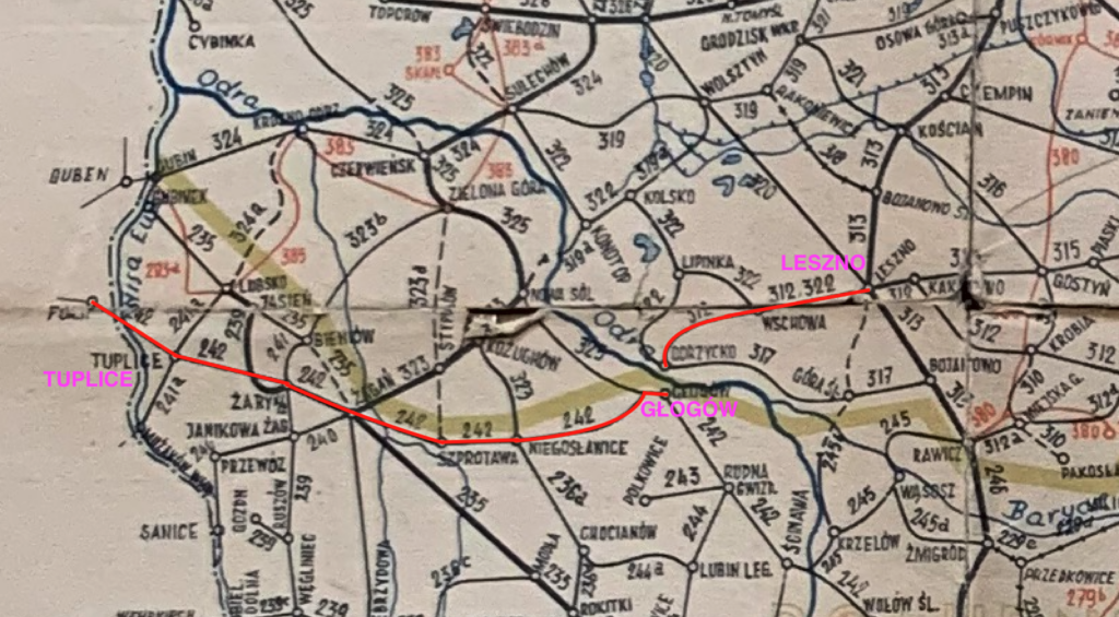
In 1844, a committee was formed to build the Glogau-Lissauer Zweigbahn (Głogów-Leszczyńska Branch Railway). In 1853, the Oberschlesische Bahn (Upper Silesian Railway) received a construction concession. Construction began near Leszno, with work being carried out simultaneously in three directions; Poznań, Wrocław and Głogów. The latter line was built in two stages. The first stage was completed on 30 December 1857, with rail traffic starting from Leszno via Wschowa to the Oder line, near the town of Grodziec Mały. The second section was opened on 18 May 1858, after the construction of two bridges over the Oder and Stara Oder. The first was 190 m long, the second 454 m long and had 12 spans. Work on the reconstruction of the fortifications on Ostrów Tumski (Odra Island) was also completed. The entire Leszno – Głogów railway line is 45 km long.
In the second half of the 19th century, Leszno developed rapidly. In 1880, the city had 12,000 inhabitants, and in 1910, it had 23,000 inhabitants. People from nearby villages came to the city in search of a better life and work. The magnet was the growing industry; a pump factory, a grain mill, spirit production plants, but also crafts and trade. In 1856, Leszno gained a railway connection with Poznań and Wrocław. In 1857, trains began running to Głogów, and soon also to Wolsztyn and Ostrów Wielkopolski. The railway connection to Ścinawa, where there is a river port on the Oder, is not without significance. Leszno became a window to the world.
After World War II, traffic on the Leszno – Głogów route was small and irregular. The railway infrastructure was degrading, as were the bridges on the Old Oder and the Oder. The speed of trains decreased, and there were sections with a speed of only 20 km/h. Some stops and loading bays were closed. The last regular passenger train passed through this section in December 2011.
Currently, a section of line No. 14 Leszno – Głogów runs through the territory of three provinces; Lubuskie (18 km), Wielkopolskie and Dolnośląskie, of which the longest section is in the territory of the first province. This was a big problem, given the existing regulations. The matter had to be submitted to the ministry. The renovation began in 2016 and was to restore the route’s passability at speeds of up to 100 km/h. The renovation covered 30 kilometers of track. After many years of interruption, on December 15, 2019, passenger connections were launched on the Leszno – Głogów line. The local governments of Głogów and Wschowa contributed significantly to the reactivation of passenger traffic, contributing financially to the renovation.
The train journey from Wschowa to Leszno takes less than 20 minutes and is the fastest alternative on this route, even faster than traveling by car. The line is operated exclusively by the PolRegio carrier’s SZT, Lubuski branch. It cannot be hidden that the carrier has only 20 DMUs and when the vehicles go for inspections, it is necessary to borrow trains from other carriers. Currently, the route is serviced by 8-10 pairs of trains. Currently, there is an LCS (Local Control Center) in Leszno. Railway lines in Leszno: LK No. 14, 271, 359, 817.
Another railway line ran from Leszno to the south, to Góra Śląska and further to Lower Silesia. The Leszno – Korzelów line was owned by several dozen shareholders. In Leszno, the line had its own railway station; Zaborowo, currently a district of Leszno. The line was opened in 1916. Unfortunately, the Germans wanted a great world war and as a result, they lost a lot. The line was cut by the state border Poland – Germania. The course of the line; Zaborowo near Leszno – Henrykowa near Leszno – state border – Witoszyce Chróścina – Glinka – Sławęcice Górowskie – Góra Śląska. At the Sławęcice Górowskie station, the line crossed with another local line Bojanowo – Głogów, which ran latitudinally. Today, there are barely visible traces of the railway in the area. There are old tracks and railway embankments, brick bridges and culverts, and ruins of small railway stations. Here and there, bicycle paths have been built that lead into the forest. In the town of Osetno, the skeleton of a steel railway bridge, consisting of three spans, over the Barycz River, remains. The last freight train passed this line in 1961.
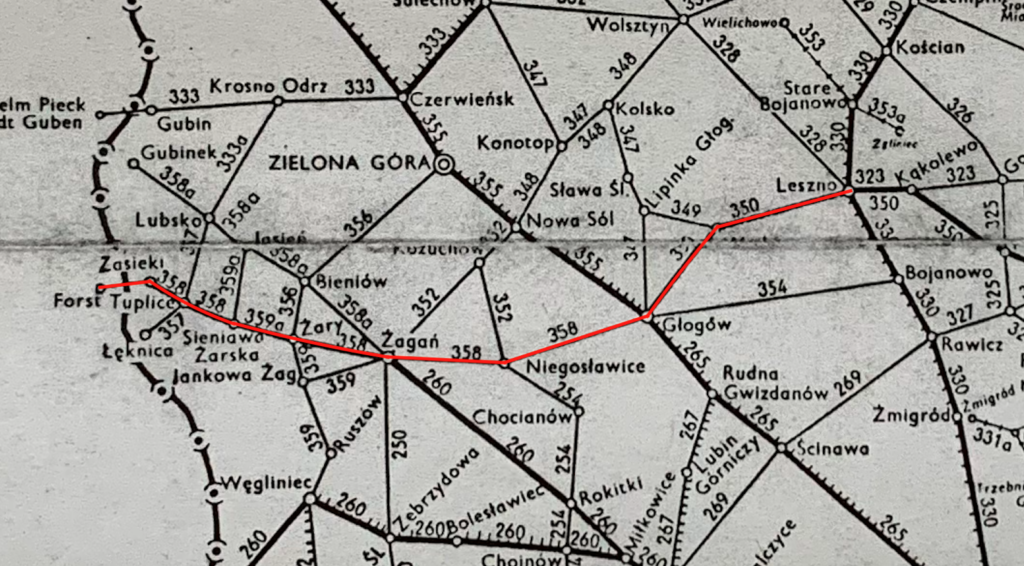
The course of the Leszno – Tuplice railway line.
Line No. 14 leaves Leszno station towards the south and turns in a long arc towards the west. The line passes under the viaduct of DK No. 12. Then the line enters the forest and passes under the S5 motorway. Lasocice station (242.79 km, elevation 88 m). From the station there are railway sidings to the poultry farm and the elevator. Then the line runs through fields and forests. At 266.70 km, there is the border of the Wielkopolska / Lubuskie provinces, and during the Second Polish Republic there was a state border with Germany. The line crosses the Krzycki Rów river. The line crosses the intersection of DW No. 305.
Wschowa station (254.75 km, elevation 91 m). Here was the beginning of the former LK No. 387 in the north-west direction, towards the town of Stare Strącze. In the interwar period, it was a Germanic border station. In Wschowa, there was a large sugar factory, which was liquidated. There is a viaduct at the station, where DK No. 12 runs over the top. Currently, 14 passenger trains depart from Wschowa station daily. You could go to the following stations: Głogów, Leszno, Zielona Góra Główna. All trains are operated by the PolRegio carrier. Wschowa is a city in the Lubuskie Province, the seat of the Wschowa district and the urban-rural commune of Wschowa. Wschowa is located in the historical Wielkopolska region. According to data from 2019, Wschowa had 13,851 inhabitants.
Stare Drzewce passenger stop and loading bay (263.32 km, elevation 94 mm). At 266.74 km there is the Lubuskie / Lower Silesian provincial border. The line enters the forests. Głogów Gaj passenger stop (269.06 km, elevation 85 m). Głogówko passenger stop and passing loop (271.55 km, elevation 79 m). From the Głogówko stop the line has two tracks, but only one is used. The line turns in a gentle arc towards the south and crosses the Krzycki Rów river. Next there is an intersection with DW No. 319. Grodziec Mały passenger stop (277.19 km, elevation 75 m). There used to be a line here towards the north, LK No. 305, towards Wolsztyn. DW No. 321 runs above the line. Odrzycko branch post (278.89 km, elevation 76 m), LK No. 372, towards the east to Góra Śląska and further to Bojanowo.
Further on there are bridges over the rivers; Stara Odra and Odra. Each bridge is double, but only one track is used. In the fork of both rivers, on Obrowo Tumskie, there is a fort called Malakpff, which was expanded to protect the bridges and the railway line. The first railway bridges were built at the beginning of the second half of the 19th century. Initially, trains from Leszno only reached Grodziec. Further on to Głogów, passengers were taken by carriages over a road bridge. This was the case until 1858, when two bridges were built, the first 190 m long, and the second 454 m long. These were truss bridges, rectangular in shape, typical for bridges of that period. Finally, the first trains crossed the bridges on May 18, 1858. At the end of the 19th century, the bridge over the Odra was rebuilt. The bridge was already double-track at that time. Interestingly, a safe pedestrian crossing was built on the western side. In the mid-1930s, the bridge crossing underwent another reconstruction. During this renovation, the pedestrian walkway was eliminated. In 1945, as a result of war operations, the bridges were destroyed. The spans were thrown off the pillars. In 1946, the bridges were renovated and trains were launched again in 1947. In 1968, the bridges were renovated by Przedsiębiorstwo Robót Kolejowych Nr 15, Warsaw. The bridge over the Old Oder is 245 m long. Currently, the track on the western side is operational. The bridge over the Oder is 180 m long. The longest span is 72 m long. Currently, the track on the western side is operational.
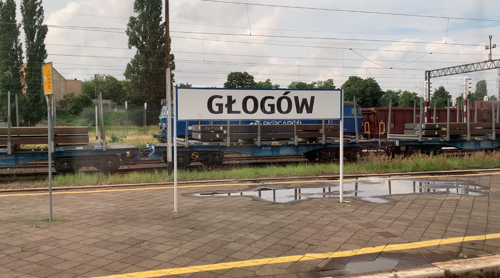
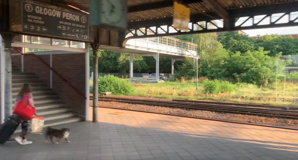
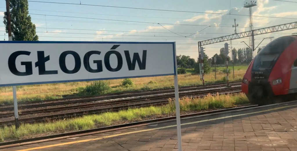
Głogów junction station (280.50 km, elevation 77 m). LK Nr 14 (Platform 3, 4), LK Nr 273 (Nadodrzanka, Platform 1, 2). On May 15, 2025, 69 passenger trains departed from Głogów. You could travel to the following stations: Frankfurt/Oder, Kraków Główny, Legnica, Leszno, Przemyśl Główny, Szczecin Główny, Świnoujście, Wrocław Główny, Zielona Góra Główna. Carriers: InterCity, Koleje Dolnośląskie, PolRegio. Głogów is a city in Poland located in the Lower Silesian Voivodeship and is the seat of the Głogów district. In 2020, Głogów has 66,120 inhabitants. The city is located in the Legnica-Głogów Copper District. The city is developing along the left bank of the Odra River. At the Głogów station, on the northern side, there is the Głogów Port Rzeczy, where there are railway sidings. Already in the freight part of the station, railway lines No. 14 and No. 273 diverge.
LK No. 14 runs closer to the Odra River and becomes a single-track line. At the top, the line passes over LK No. 273 and over DW No. 292. Żukowice passenger stop (287.24 km, elevation 95 m). Then the line goes south in S-shaped arcs, and finally heads west. The line crosses the Średni Potok River. Nielubia passenger stop (291.15 km, elevation 128 m). At the stop, there is a rail-road crossing along DK No. 12. Then there is another intersection with DK No. 12. Then the line runs under the S3 motorway. Kłobuczyn passenger stop (295.38 km, elevation 150 m). There used to be a loading bay here. Then the line passes under DW No. 333. Gaworzyce passenger stop (299.49 km, elevation 145 m). At 302.68 km is the border of the Lower Silesian / Lubuskie provinces. The line runs through cultivated fields and forests. Przecław Szprotawski was a station (306.45 km, elevation 135 m). The station was located on a local asphalt road. There are no households or workplaces nearby. The line crosses DW No. 328 at an intersection.
Niegosławice station (312.19 km, elevation 144 m). Another name Dworcowy Przysiółek. Railway junction, intersection with LK No. 303, which runs meridionally, north to Nowa Sól, and south to Lubin and Rokitki stations. The line is mostly impassable. Only the Rokitki – Chocianów section is operational. At the station there is a large brick railway building, a warehouse (?). Further on there is a brick railway viaduct over the Suchy Potok river. Dzikowice passenger stop (318.63 km, elevation 140 m). At 319.90 km, there used to be a passenger stop. A brick guardhouse building remains, which stands at the local asphalt road. Further on, in the city of Szprotawa, there is an intersection with DK No. 12.
Szprotawa station (324.00 km, elevation 132 m). Szprotawa is a city in the Lubusz Voivodeship, in Żagań County, the seat of the urban-rural commune of Szprotawa. The city is located on the rivers; Bóbr and Szprotawa. According to data from 2021, Szprotawa had 10,954 inhabitants. The city is an industrial and service center. Szprotawa was a Soviet military garrison with a large airport, east of the city, and previously there was a large prisoner of war camp here. Szprotawa station was opened in 1846. Currently, it is a freight hold. Currently, no passenger trains pass through the station. Until October 2000, trains on the Głogów – Żagań route ran here. In the period 2006-2010, passenger train traffic was resumed on the short Żagań – Niegosławice route. However, due to low attendance and the lack of diesel rolling stock, traffic was suspended again. At the Szprotawa station, there is an abandoned historical station, with a warehouse building adjacent to it. There is also a newer building at the station, built in the 1960s, which currently houses a pharmacy and a health clinic. In the past, the station had an underground passage to the only island platform. There was also a water tower. In the western head of the station, there is a viaduct over Kopernika Street. The viaduct was built in 1846, it is arched, built of brick and stone. In its history, the viaduct was widened while maintaining the crossing light (1911, 1922). The street is asphalt. The facility is in good technical condition. Further on, behind the Szprotawa station, towards the north, LK No. 273e branched off, to the Stypułów station and then to the Nowa Sól station. A little further south, a siding led to the no longer existing steelworks, on the Bóbr River.
Then the line runs under a local road, Żagańska Street. There is a viewing point on the viaduct, which was called “MK SU46”. Next is the Bukowina Bobrzańska passenger stop (331.99 km, elevation 128 m). At the stop there is a two-storey brick station, which is currently occupied by apartments. Next is the Bober branch station (336.88 km, elevation 113 mm). Here LK No. 371 led north, towards the Stypułów station. The line was liquidated.
Line No. 14 crosses the Bóbr River. The bridge is called the “Red Bridge” and is 186 m long. The railway bridge over the Bóbr River is one of the most beautiful monuments of technology. One track was laid on it, but there is room for a second track. The bridge was built of brick and is supported by 19 pillars and two abutments. On the bridge, 9 platforms were built on each side (north and south) on protruding pillars. The main stream of the Bóbr River flows only under the western part of the bridge. The bridge is in good condition.
Next, line No. 14 runs over the Legnica – Żagań railway line. There is room for three tracks on the viaduct, but there is only one. Next, the line runs under the truss viaduct of the dismantled railway line. The line crosses Żelazna Street at the top. Line No. 14 centrally enters the Żagań station and its track runs at Platform 3.
Żagań junction station (340.53 km, elevation 114 m). Railway lines No. 14, 275, 283, 371, 389. Żagań is a city, which is both an urban commune and the seat of the rural commune of Żagań, located in western Poland, in the Lubusz Voivodeship, on the border of the Silesian-Lusatian Lowland and the Trzebnicki Rampart, on the Bóbr and Czerna Wielka rivers. In 2019, the city’s population was 25,668 inhabitants.
In January 1845, it was decided to build a railway route from Głogów to Żagań. The investment was supported by the Prussian king Frederick William IV. The investor was the Lower Silesian-March Railway Company. The first train arrived at the station in Żagań from Głogów via Niegosławice and Szprotawa on 26 July 1845. The train brought rails and sleepers for further construction of the railway route. The Głogów – Żagań route is 71 km long. Interestingly, the next section of the railway line was first laid to the town of Jankowa Żagańska, because its owner invested her funds. The further route towards the town of Żary was launched on 1 November 1846. At the same time, the Węgliniec – Żary railway line was launched. In 1875, a connection with Legnica and Wrocław was launched. New lines to Stypułów and Kożychów were launched on 1 October 1890. A new line to Świętoszów was opened in 1905. Within 50 years, Żagań became a large railway junction, with seven railway lines leaving from there. The railway bridge over the Bóbr River still exists today, and was built in the period 1845-1846. All new railway lines were built in such a way as to easily lay a second track, both on the railway embankments and at the bridgeheads. But ultimately the second track was received by the railway line: Żagań – Maroszów – Żary – Sieniawa Żarska.
Currently (2022) the following railway lines run through Żagań: railway line No. 14 Łódź Kaliska – Forst/Baršć, railway line No. 275 Wrocław Muchobór – Guben, railway line No. 283 Jelenia Góra – Żagań, railway line No. 371 Wolsztyn – Żagań, railway line No. 389 Żagań – Jankowa Żagańska. In Żagań, freight traffic is high and passenger traffic is low, mainly served by diesel multiple units. The railway junction in Żagań is not electrified, which is why steam locomotives reigned here for many decades, and from the 1960s, diesel locomotives joined them. On May 15, 2025, 33 passenger trains departed from Żagań station. You could go to the following stations: Cottbus, Görlitz, Legnica, Małomice, Przemyśl Główny, Tuplice, Węgliniec, Wrocław Główny, Zgorzelec, Zielona Góra Główna, Żary. Carriers: PolRegio, Koleje Dolnośląskie. There is also one InterCity train No. 76106 Mehoffer ZIELONA GÓRA GŁÓWNA – PRZEMYŚL GŁÓWNY.
LK No. 14 leaves the Żagań station towards the west as a double-track line. The line enters the forest and crosses the Czarna Wielka river, via a historic bridge. Marszów was a passenger stop and a loading bay (348.49 km, elevation 139 m).
From the east, LK No. 14 and a line from the Jankowa Żarska station enter Żary station. Żary is a junction station (353.36 km, elevation 156 m). Railway lines No. 14, 282, 370. Żary is a city, which is both a municipal commune and the seat of the rural commune of Żary, in the Lubuskie Voivodeship, on the southern edge of the Trzebnicki Wall. In 2021, the population of Żary was 36,004 inhabitants. On May 15, 2025, 43 passenger trains departed from the station. You could go to the stations: Cottbus, Görlitz, Legnica, Małomice, Przemyśl Główny, Tuplice, Węgliniec, Wrocław Główny, Zgorzelec, Zielona Góra Główna, Żagań. Carriers: PolRegio, Koleje Dolnośląskie. There is also one InterCity train No. 76106 Mehoffer ZIELONA GÓRA GŁÓWNA – PRZEMYŚL GŁÓWNY.
Two lines leave from Żary station to the west. One to the north, passes over LK No. 14 and leads to Zielona Góra Główna. LK No. 14, as a double-track, runs to the west. The line runs under the viaduct of Stanisława Moniuszki Street and DK No. 12, 27 (city bypass). On the northern side there are sidings to the SWISS KRONO furniture factory. Then the line enters the forest again. Sieniawa Żarska passenger stop (358.64 km, elevation 154). The station is single-storey and houses the “SŻ” signal box and a warehouse. Here the double-track line becomes single-track. Behind the station to the west, LK No. 282 leaves to the Jasień station, to the north. The line is out of service. Line No. 14 crosses the Sinica and Lubosza rivers. Lipinki Łużyckie passenger stop (362.64 km, elevation 147 m). The line crosses the Tymnica River. Tuplice Dębinka passenger stop (369.82 km, elevation 141 m). It used to be a station. Tuplice station (374.84 km, elevation 123 m). LK No. 14, intersects with the inactive LK No. 365, in the meridianal direction; Stary Raduszec – Mużaków. In the village of Tuplice, there was a brickyard near the station. In the western head of the station, there is a rail-road crossing along DW No. 294, 9 Maja Street. Further on, the line passes under Kościuszki Street. Further on, the iron bridge of the liquidated LK No. 365 has been preserved. Further on, there are still forests. Myszków goods station (383.42 km, elevation 88 m). The station is currently inactive. Zasieki passenger stop (388.60 km, elevation 79 m). There was a passing loop here. There is a single-storey station building here (address Zasieki No. 29A).
Border Republic of Poland / Federal Republic of Germany (389.08 km). LK No. 14 changes to LK No. DE 6205. The border is the Lusatian Neisse River. The bridge is double, each for one track. The spans are truss, steel, riveted. There are 6 spans for each track. The total length of the bridge is 193 m. The spans stand on concrete pillars. There are two tracks on the bridges, but only one is used. The one on the northern side.
Written by Karol Placha Hetman