Radom 2026-01-02
Railway Line No. 26 Łuków – Radom.

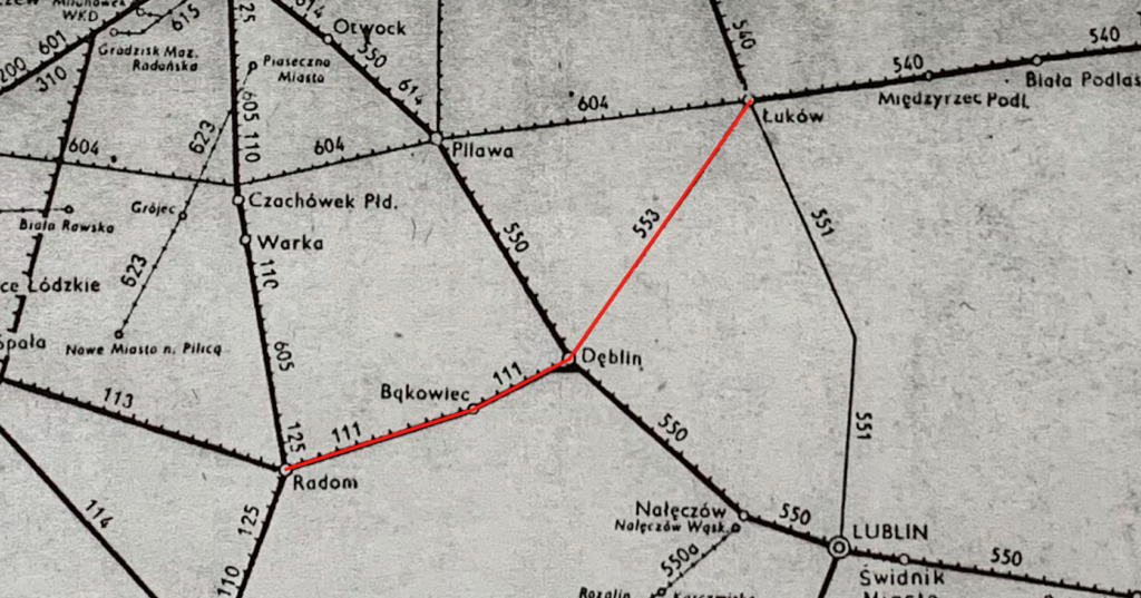
Railway Line No. 26 Łuków – Radom is a double-track line, electrified at 3 kV DC. The line is 117.108 km long. Train speed is 120 km/h.
The line was created from two different sections of railway lines in the Kingdom of Poland in the 1870s. Both have a track gauge of 1524 mm. In 1876, the Łuków – Iwanogród (Dęblin) section was opened, a branch line forming part of the Warsaw – Terespol Railway. In 1885, the Ivanogród–Radom section, along with a railway bridge over the Vistula River, was opened. In 1935, a connecting line was built in Dęblin, enabling direct train travel from Łuków to Radom without changing locomotive heads. Thanks to reconstruction after the Great War, the entire line has a standard gauge of 1435 mm. Electrification: In 1967, the Dęblin–Radom section was electrified, and in 1988, the Łuków–Dęblin section followed.
The Lublin section of LK No. 26, Łuków–Dęblin, was built in the 1870s. The line connected the Warsaw-Terespol Railway with the Vistula Railway and the Ivanogród (Dęblin) fortress. It was a purely military connection. The line’s geometry allows passenger trains to run at 120 km/h and freight trains at up to 100 km/h. Currently, LK No. 26 is primarily used for freight traffic. It connects southern Poland with the Małaszewicze terminal. Passenger traffic is handled by four pairs of trains. On January 2, 2026, eight trains departed from Krzywda station for stations: Chełm, Lublin Główny, Łuków, and Terespol. Only PolRegio trains run here. Long-distance trains are not scheduled to run on the route. The route runs through the northwestern areas of the Lublin Voivodeship, sparsely populated and urbanized. These areas include the Łuków and Ryki counties, with a mosaic of farmland, forests, and wasteland, along with numerous slow-flowing rivers and small lakes. There are two important stations on the route: Krzywda and Leopoldów, with identical station buildings. The latter station is currently closed.
The Dęblin-Radom section of LK No. 26 is different. The line runs through more populated areas, the Kozienice Forest (Kozienice Landscape Park), and farmland with better soils. There are tourist and recreation centers here, a good road network, and industrial plants.
Line No. 26 begins at Łuków station and runs through smaller towns southwestward. Key points include Łuków Łapiguz (stop and platforms), Krzywda, Okrzeja, Leopoldów, Ryki, Stawy, and Dęblin. Dęblin is a major railway junction with connections to Warsaw, Lublin, and Radom. Further afield are Zajezierze, Garbatka Letnisko, Pionki, Jedlnia Letnisko, Radom Wschodni (freight), and Radom Główny.
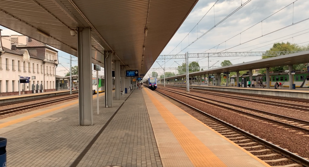
Passenger traffic is handled by regional carriers and PKP InterCity on the Dęblin-Radom section. Freight traffic runs along the entire length of Line No. 12, allowing trains to run latitudinally, northeast, and southwest.
In 2024, the modernization of Line No. 26 began. The main goals are to increase commercial speed, safety, and capacity on the route. Work was carried out on the following sections: Łuków – Łuków Łapiguz section: rail and sleeper replacement, renovation of the bridge over the Krzna River, and improved safety at crossings. Łuków Łapiguz – Dęblin section: track replacement, increasing freight train speeds to 100 km/h and improving safety at level crossings. A new passenger stop was built in Radom Wschodni, located under the Lubelska Street viaduct. Further renovation and modernization work is planned. The overhead line on the Dęblin – Radom section (Żytkowice – Vistula bridge) will be replaced, aiming to improve technical parameters and enable traffic speeds of up to 160 km/h after the modernization is completed. Work on the overhead line and further modernization of the track infrastructure will be carried out in 2026.
Łuków – Radom Railway Line No. 26:
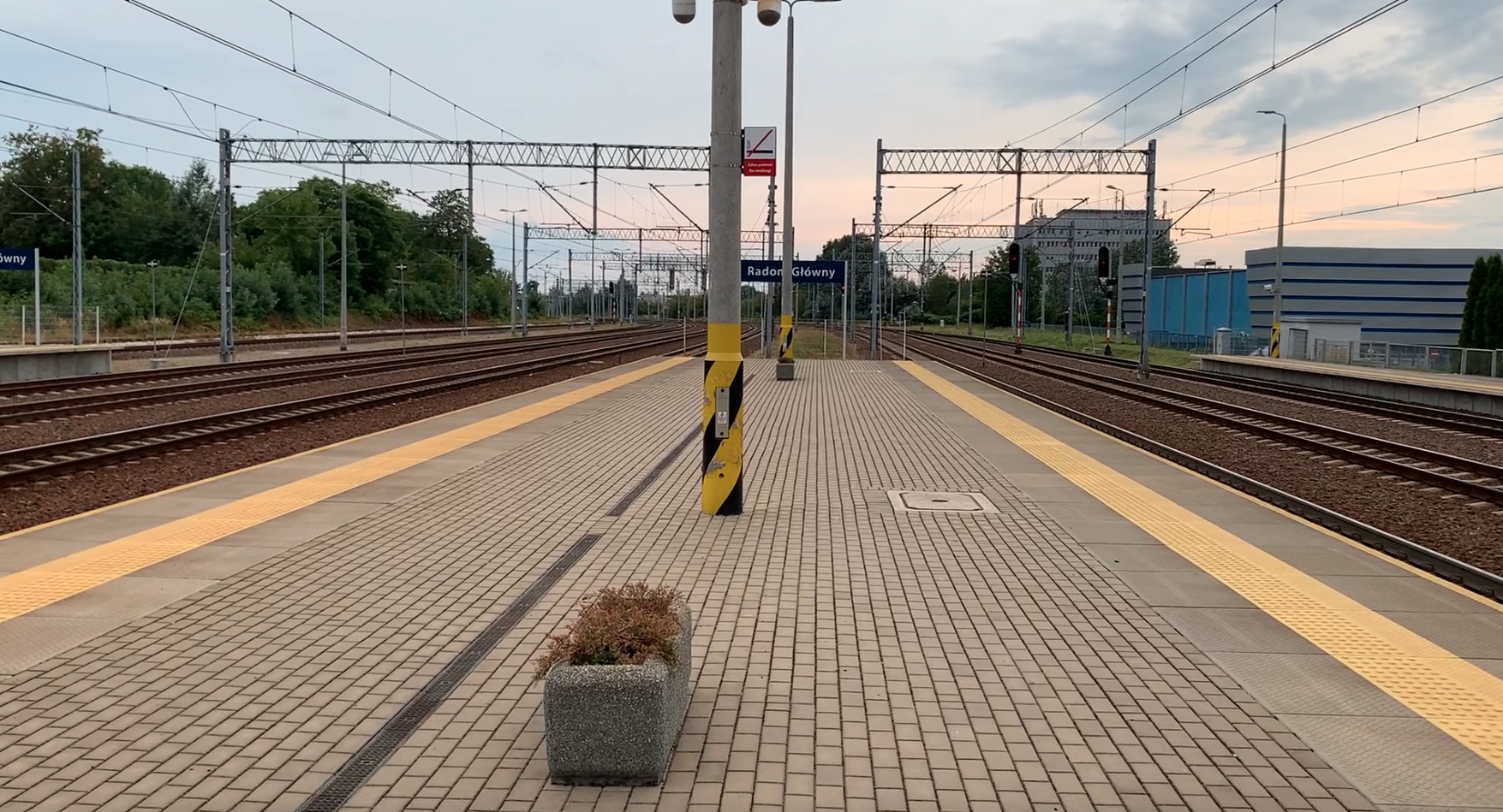
Łuków junction station (0.00 km, elevation 166 m) LCS. Other railway lines: 2, 12, 30. The line curves to the left, heading southwest. The line passes Jana Pawła II Street, Siedlecka Street, Ławecka Street (DK No. 63), the Krzna Południowa River, and Parkowa Street. On the western side are Młyny Zborzowe. Łuków Łapiguz station (3.92 km, elevation 166 m). Before the platform is the level crossing (DK No. 76) at Warszawska Street. After the station is the level crossing (DW No. 807) at Żelichowska Street. Świdry was a blocking post (8.56 km, elevation 164 m). The post was located near the level crossing of a local road. The village of Świdy is located east of the railway line. The line then runs through the farmland of the villages of Szczygły Górne and Szczygły Dolne. There is a level crossing along Wspólna Street. The line crosses the Bystrzyca River and two railway crossings: Leśna Street and Strażacka Street. Sarnów has a passenger stop (km 14.09, elevation 164 m). Before the platforms, there is a railway crossing on Akacjowa Street, and then another railway crossing. Borowina has a passenger stop (km 16.90, elevation 163 m). Beyond the platforms, there was a railway crossing on a local road. The line enters the forest. Burzew was a former blocking post (km 17.54, elevation 159 m). The line crosses the Mała Bystrzyca River and then two local roads. Krzywda had a station and a passenger stop (km 22.55, elevation 174 m). The station is located in the very center of Krzywda. The station features a historic water tower and a station, which is now the Cultural Center. Behind the station, there’s a crossing along Łukowska Street, the village’s main artery. The line then runs through fields and forests. Huta is a former sectional station (km 26.67, elevation 182 m). Hordzieżka is a passenger stop (km 27.95, elevation 178 m). Behind the platforms, there’s a crossing along a local road. This is the main and only road in the village of Hordzieżka, which is a typical linear village. Okrzeja is a station (km 30.94, elevation 178 m). The station is located in a very small village surrounded by fields and forests. Further along, the line crosses Leśna Street. Grabów Szlachecki is a passenger stop (km 35.26, elevation 179 m). The village is approximately 0.5 km southeast of the stop. Two local roads cross the line. Leopoldów is a passenger stop, a former station (km 42.20, elevation 180 m). Leopoldów is a large, dispersed village, located on both sides of the railway line. Rososz and Oszczywilk are former sectional checkpoints (45 km, elevation 158 m). Janisze was a sectional checkpoint (48.34 km, elevation 143 m). The line approaches the town of Ryki in several curves, overcoming terrain differences ranging from 180 m to 135 m. The line runs under the S17 motorway, then the Zalesianka River, and then under Lubelska Street (DW No. 839). There are industrial areas and factories here, and on the northern side are ponds and a large sewage treatment plant. Ryki is a loading bay and passenger stop, a former station (53.18 km, elevation 135 m). On the northern side, a military siding from a military unit located in the forests runs. Ryki is located on the northern side, approximately 3 km from the station. Stawy station (55.71 km, elevation 128 m). Line No. 579. Dęblin R11 turnout (59.67 km, elevation 125 m). Line No. 770. Dęblin station (61.44 km, elevation 119 m). LK No. 7, 579. The track layout allows trains to enter Dęblin station from both sides, which facilitates further train dispatch.
Dęblin freight line (62.57 km, elevation 119 m). Line No. 7, 770. Line No. 26 bypasses the freight station tracks from the east, of which there are four on this section of the route. The line passes under the viaduct of Warszawska Street, DK No. 48. Here, line No. 26 branches off the line towards Lublin. The line passes under Podchorążych Street, DW No. 801, and on the north side is the Dęblin Wisła signal box. Wisła junction station (64.88 km, elevation 117 m). Line No. 7, 580. Here, tracks from the Lublin direction join from the north. The railway bridge over the Vistula River in Dęblin has five truss spans, each carrying two tracks. The line then runs over road No. 1737W. The railway line is joined from the west by 28 Pułku Artylerii Lekkiej Street, National Road No. 48. Zajezierze near Dęblin has a station (67.04 km, elevation 116 m). The station is located in the center of the town, which has dense development. The terrain necessitated the line running through several curves. The fort was a branch post (70.14 km, elevation 113 m). The name comes from the former Bem (Wannowski) Fort. The line once again crosses a road at a railway crossing. Road No. 1737W. Further on, the line crosses National Road No. 691, and then road No. 1731W. Sieciechów has a former passenger stop (73.06 km, elevation 117 m). Bąkowiec has a station (74.95 km, elevation 120 mm). LK No. 76, 82. Bąkowiec Branch and switch (76.62 km, elevation 122 m). LK No. 578. The station is located in the forests. Here, a siding to the Kozienice Power Plant branches off. The station is at DW No. 782. Further on, the line crosses DW No. 738. Zawada former block post (78.79 km, elevation 132 m). Garbatka Letnisko station (81.98 km, elevation 153 m). LK No. 577 m. Here there is a switch on the southern side of the siding to the Kozienice Power Plant. Garbatka is a relatively large village with numerous single-family houses. The line crosses DK No. 79. Bobki former block post (85.83 km, elevation 159 m). Żytkowice station (87.20 km, elevation 159 m). Żytkowice station has an extensive track system. Historically, it has served military and economic functions (for the forestry industry). A unique feature of the station is its western entrance, with nearly all tracks terminated with buffer stops. The station is operational. A prison is located in the western part of the station. Laski was a block station (km 90.09, elevation 155 m). Pionki station (km 93.94, elevation 152 m). Pionki is a compact village with numerous single-family homes and a housing estate. Beyond the station is a level crossing. The line then crosses Adama Mickiewicza Street (DW No. 787) via a viaduct. Pionki Zachodnie is a passenger stop (km 95.71, elevation 154 m). Poświętne was a block station (km 97.05, elevation 156 m). Jedlnia Kościelna passenger stop (98.66 km, elevation 167 m). Adolfin former blocking post (99.79 km, elevation 168 m). Jedlnia Letnisko station (104.99 km, elevation 162 m). There is a crossing here along Kolejowa Street DW No. 699. There is a footbridge over the tracks for residents and travelers. Groszowice Wrzosów passenger stop (106.79 km, elevation 159 m). There is a crossing here along Akacjowa Street. Antoniówka passenger stop (108.51 km, elevation 166 m). Before the platforms there is a crossing along a local street. Rajec Poduchowny passenger stop (110.59 km, elevation 177 m). After the platforms there is a crossing along a local road. Rajec former blocking post (112.22 km, elevation 178 m). Next, the line runs under the viaduct of Rajec Szlachecki Street, national road No. 12. Then there is a passage under national road No. 9 (E371). The Radom railway junction has begun to be cleared. Radom Wschodni freight station and passenger stop (116.51 km, elevation 167 m). LK No. 8, 585. The line passes under the viaduct; Lubelska Street and the viaduct of Juliusza Słowackiego Street. Radom Główny station (118.11 km, elevation 166 m). LK No. 8, 22, 585.
Written by Karol Placha Hetman